
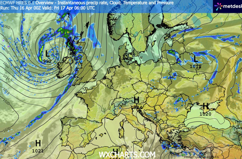
The United Kingdom is experiencing a classic “Friday of two halves” as a sweeping Atlantic weather front tracks across the country today, Friday 17 April 2026.
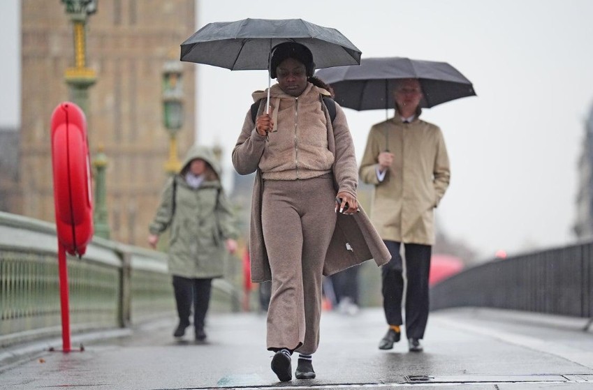
While the morning provided a warm, bright start for the South East, meteorologists warn that a band of rain is currently migrating eastward, bringing an end to the brief dry spell.
However, the outlook for the weekend remains promising, with high pressure set to clear the skies and offer a much-needed reprieve for outdoor plans on Saturday.
How is the Atlantic Front Reshaping Today’s Forecast?
The primary driver of today’s weather is a slow-moving band of rain that is currently bisecting the UK. As of mid-morning, this system has already brought persistent rainfall to Northern Ireland, Wales, and Western Scotland.
The front is moving at a steady pace, with the rain expected to intensify slightly as it moves into the Midlands and Northern England by mid-afternoon.
A wet and windy start for some on Friday morning as a band of rain moves eastwards 🌧️
Sunshine and showers in the west once rain clears 🌦️
Mostly dry with some warm sunny spells in the southeast 😎 pic.twitter.com/bj9EPr6uAc
— Met Office (@metoffice) April 16, 2026
Ahead of this band, regions like East Anglia and Greater London are enjoying temperatures reaching highs of 18°C. This warmth is, however, temporary; as the rain arrives later this evening, temperatures are expected to dip, replaced by a fresher, blustery air mass.
Behind the main rain band, the atmosphere remains unstable. This is triggering a “sunshine and showers” regime in the West, where heavy, blustery bursts are likely to catch residents off guard between periods of bright spring sun.
Which UK Regions Are Facing the Greatest Disruption?
The impact of today’s weather system is highly regionalized, affecting transport and daily life differently across the four nations:
- The South East & London: The rain is not expected to reach these areas until the late evening commute (approximately 7:00 PM onwards). While the day remains warm, the Friday night “getaway” may be hampered by surface spray on the M25 and M23.
- The North West & Midlands: Cities such as Manchester, Liverpool, and Birmingham are seeing the transition now. The Met Office indicates that rain here will be accompanied by gusty winds, particularly on higher ground like the Pennines.
- Scotland & Northern Ireland: Western Scotland continues to bear the brunt of the Atlantic influence. Showers in the Highlands may turn wintry over the highest peaks, though no significant accumulation is expected at lower levels.
- The West Country: In Devon and Cornwall, the rain has largely cleared, leaving a breezy afternoon with clear visibility, making it the pick of the regions for late-afternoon coastal walks.
What are the Official Sources Advising for Commuters?
The Met Office has not issued any formal Yellow warnings for today, but they urge caution during the transitional period this evening.
A spokesperson stated: “The rain will continue to clear eastwards through tonight, weakening as it does so. While the South East sees a damp end to the day, high pressure is already building from the west, which will dominate the weekend story.”
National Highways has advised motorists on the M6 and A1(M) to expect reduced visibility during heavy bursts this afternoon.
Meanwhile, the Environment Agency has kept three groundwater flood alerts active for the Alton and Great Shefford areas, noting that while today’s rain is not excessive, the ground remains saturated from a damp start to April.
Will the Weather Impact UK Travel and Public Services?
For the millions of people planning a Friday evening or Saturday morning journey, the transition in weather presents several logistical considerations:
Rail and Road Transport
Network Rail has monitored wind speeds in the North West but does not anticipate widespread speed restrictions. However, the combination of light rain and spring pollen can create “greasy” road surfaces.
National Rail passengers are advised to check for minor delays on coastal routes in Scotland, where blustery conditions are most prevalent.
Public Events and Leisure
With Saturday’s forecast looking significantly drier, tourism hubs such as the Lake District and the Cotswolds are expecting a surge in visitors.
Local councils in coastal towns are preparing for increased footfall as the “bright and sunny” Saturday morning forecast encourages the first major spring outings of the season.
Why is Saturday Set to be a “Turning Point” for the Weekend?
As the rain clears the far southeast of England in the early hours of Saturday, 18 April, a ridge of high pressure will establish itself across the British Isles.
- Morning Clearance: By 8:00 AM on Saturday, most of the UK will be dry. Any lingering cloud in Kent and Sussex will move into the English Channel, leaving clear blue skies for the majority of England and Wales.
- Afternoon Outlook: Temperatures will feel cooler than Friday, averaging around 13°C to 15°C, but with light winds and prolonged sunshine, it will feel pleasant.
- Northern Showers: Scotland and Northern Ireland will remain slightly more “changeable,” with scattered showers persisting through the morning before fading by sunset.
This shift marks a more stable period of weather that forecasters suggest could last well into the early part of next week, providing a consistent “settled spell” across the UK.