
The United Kingdom is set to enjoy a period of settled, dry weather over the next 48 hours as a robust ridge of high pressure establishes itself across the British Isles.
For most of the country, Wednesday, 22 April, and Thursday, 23 April, will deliver a much-needed dose of spring sunshine, providing a stark contrast to the unsettled conditions seen earlier in the month.
While the majority of the UK will bask in clear skies, the forecast is not uniform. A persistent easterly breeze will keep coastal areas in the east feeling decidedly chilly, while residents in Cornwall and Devon must contend with strong, gusty winds.
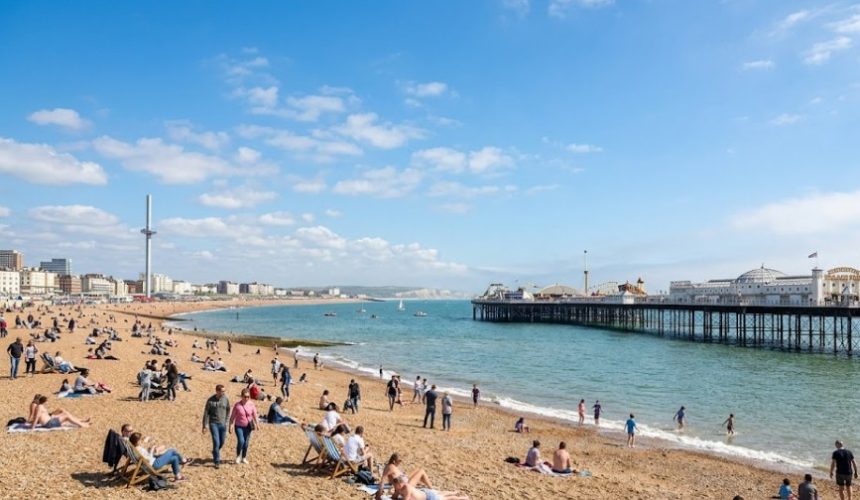
As we move deeper into the week, temperatures are expected to climb, with some southern regions potentially reaching 20°C by Thursday afternoon.
Why is the UK Seeing This Sudden Spring Settled Spell?
Following a turbulent start to April, which included the impact of Storm Dave and record-breaking early heat, the UK’s meteorological pattern has shifted into a more traditional spring “blocking” pattern.
High pressure is currently centered to the north and east of the UK, acting as a buffer against Atlantic weather fronts.
This setup ensures that most of the UK remains dry. On Wednesday, the sun will be a dominant feature for many, though “haars” or sea fret (low-lying coastal cloud) may plague parts of eastern Scotland and northeast England.
🌬️ A very windy start in the southwest on Wednesday morning, especially near coasts and hills, so take care if travelling
☁️ Elsewhere, feeling chilly with some low cloud in places
☀️ Brightening up through the morning with plenty of sunshine, though still cool in the wind pic.twitter.com/Tnst6Nd6vj
— Met Office (@metoffice) April 21, 2026
While the sun will feel warm in the sheltered west, the “feels like” temperature in the east will be suppressed by a cool flow off the North Sea.
Which Regions are Most Affected by the Wind and Cold?
The weather experience this week depends heavily on your proximity to the coast and your latitude.
The Southwest: Gale Warnings and Gusty Winds
In Cornwall, Devon, and parts of Somerset, the weather is less serene. A tight pressure gradient is generating strong and gusty winds. While the sun will shine, the wind chill will be significant. Small craft and mariners in the English Channel and Bristol Channel should remain vigilant.
The East Coast: Chilly Margins
From Aberdeenshire down to Norfolk, the story is one of cloud and cool temperatures. Eastern Scotland and northeast England are seeing the most persistent cloud cover. Temperatures here struggle to break into double digits, remaining around 9°C to 11°C.
The South and West: Approaching 20°C
Inland areas, particularly in Greater London, the Midlands, and Wales, will see the best of the warmth. By Thursday, 23 April, cities like Bristol, Cardiff, and Manchester could see the mercury rise to between 17°C and 20°C, making it one of the pleasantest days of the year so far.
What are the Official Sources Saying About This Week’s Climate?
The Met Office has highlighted the divide between the warm west and the cool east. Chief meteorologists suggest that while the weather is “fine and dry,” the overnight conditions require caution for the agricultural sector.
“With clear skies dominating the overnight period, we are expecting a patchy frost in rural areas of northern England and Scotland. Gardeners should be aware that despite the daytime warmth, temperatures could dip close to freezing in sheltered spots.”
National Highways and Transport for London (TfL) have not issued major weather alerts, but they advise commuters in the southwest to be mindful of high-frequency gusts that may affect high-sided vehicles on the M5 and A30.
How Will the Public, Commuters, and Businesses be Impacted?
The settled weather has several immediate implications for the UK public:
- Pollen Count: The Met Office has warned of Moderate to High pollen levels (specifically Birch and Ash) across the south. Hay fever sufferers in London and the Home Counties should prepare for increased symptoms.
- Travel and Commuting: While the weather is ideal for walking, those relying on public transport should note that London Tube strike actions continue to cause significant disruption across the capital’s network today.
- Energy Consumption: The rise in daytime temperatures is likely to see a temporary dip in domestic heating demand, providing a small reprieve for households.
- Agriculture: Farmers in the east remain concerned about the lack of significant rainfall, as the high-pressure system continues to block productive rain-bearing clouds.
Is This the Start of a Sustained UK Warm Spell?
The settled theme is expected to hold firm through Friday, with temperatures peaking. However, the ridge of high pressure may begin to slide eastwards by Saturday.
Expected Developments:
- Friday, 24 April: Likely to be the warmest day of the week, with 21°C possible in the south.
- The Weekend: A breakdown is expected as a cold front moves in from the northwest, bringing a return to “showery and cooler” conditions by Sunday evening.
- Long-range: Early May indications suggest a return to more volatile, Atlantic-driven weather.