
The British spring is living up to its reputation for volatility as we transition through the final days of April 2026. After a period of grey, damp conditions that have left many reaching back for their winter coats, a significant shift in the UK’s atmospheric pressure is underway.
While Tuesday, 28 April, has been characterized by a “notably cooler” feel, the latest data from the Met Office suggests a dramatic turnaround is imminent, with high pressure set to dominate the midweek period.
Is the “Grey Start” Over?
For much of England and Wales, Tuesday began with a stubborn layer of stratus cloud, bringing localized drizzle and a generally somber outlook.
This damp start was particularly felt in eastern coastal regions, where the North Sea moisture was pushed inland by a persistent northeasterly airflow.
A cloudy morning for many central and eastern areas on Tuesday, with a little light rain possible.
Brighter in the west, but rather foggy across Northern Ireland.
A mild start for most 🌡️ pic.twitter.com/7ZHMCsWit3
— Met Office (@metoffice) April 27, 2026
However, the meteorological “engine” is changing. As dry air begins to filter in from the east, the cloud deck is thinning. For residents in East Anglia and the South East, the transition from grey to bright is already occurring, though the temperature remains suppressed.
The “RealFeel” across major hubs like London and Birmingham has struggled to rise due to the wind chill, reminding us that despite the calendar, the air still holds a wintry bite.
Which UK Regions Are Seeing the Best of the Sunshine?
While the south and east have grappled with cloud, other parts of the UK are enjoying a much brighter story:
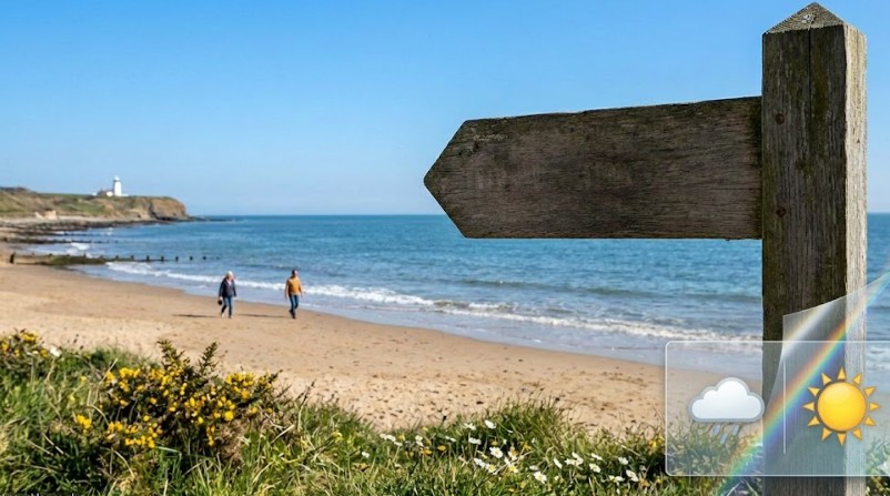
- Northern Ireland & Scotland: These regions have served as the UK’s sun-trap today. Belfast and Glasgow have seen prolonged sunny spells, though the northeasterly wind remains “brisk” along the Grampian coast and through the Forth Valley.
- The North-South Divide: Curiously, the “chilly breeze” is most felt in the south, while the northern clear skies are allowing for higher levels of direct solar radiation.
- Coastal Areas: From Newcastle down to Kent, the onshore breeze is keeping coastal temperatures several degrees lower than those found just ten miles inland.
What Are the Experts Saying?
The Met Office has emphasized that the high-pressure system is currently “blocking” Atlantic weather fronts, which is why we are seeing a lack of significant rainfall.
“The cloud will continue to break up from the east, allowing plenty of sunshine to develop. It is a fresher day for many, but the high pressure will ensure a settled 48 hours for the vast majority of the country.”
There will be a noticeable fresher feel tomorrow, with many places being 4-5 degrees Celsius cooler than today
However, it will be a few degrees warmer for those of us in the far northwest 🌡️ pic.twitter.com/4doTd2x2k4
— Met Office (@metoffice) April 27, 2026
In terms of environmental safety, the UK Environment Agency reports a stable outlook. With no heavy rain forecast, flood risks remain “Very Low” across England and Wales.
However, Defra has issued a moderate pollen warning for southern England, as the increasing sunshine triggers higher releases of birch and ash pollen.
How Will the Clear Skies Affect Your Commute and Home Life?
The shift to clear skies isn’t all good news. The lack of cloud cover tonight acts like “opening a window” for the Earth’s heat to escape into space.
1. The Risk of Late-April Frost
Commuters in rural Scotland, Northern England, and the Midlands should be prepared for a “chilly start” on Wednesday morning. Temperatures in sheltered glens and valleys could dip toward -1°C or -2°C, leading to patchy frost on car windscreens and potential hazards for local gardeners.
2. Transport and Rail Safety
National Rail has not issued major weather warnings, but early morning travelers are advised that localized fog patches may form in the north and west tonight as temperatures plummet. This could slightly affect visibility on major arteries like the M6 and A1(M) during the pre-dawn hours.
3. Energy and Heating
With the “notably cooler” northeasterly breeze lingering into Tuesday evening, domestic energy demand is expected to see a minor peak as households compensate for the lack of residual daytime heat.
Why is Wednesday Expected to be the “Pick of the Week”?
The forecast for Wednesday, 29 April, is overwhelmingly positive. Once the morning fog and frost clear, the UK is set for a “sunny day for most.”
As the northeasterly breeze begins to lose its intensity, the air will stagnate and warm up under clear skies. We are looking at a “temperature surge” where inland areas could see the mercury hit 18°C to 20°C. In sheltered spots in Devon and Somerset, it will feel genuinely warm, a stark contrast to the shivering start of the week.
What Lies Beyond Midweek?
While Wednesday and Thursday look settled, the “Atlantic tap” isn’t turned off forever. By Friday, the high pressure is expected to slide eastward, allowing an “increasing chance of showers” to move in from the West.
For those planning for the upcoming Bank Holiday, the trend appears to be moving toward a more “changeable” and potentially thundery setup.