
The United Kingdom is currently locked in a “blocking” high-pressure system that is delivering a much-needed spell of settled spring weather.
For Friday, 24 April, and Saturday, 25 April 2026, the atmospheric setup promises clear blue skies for the majority of the country, though a sharp contrast between daytime warmth and nocturnal chills is creating a complex picture for farmers and commuters.
While the “Sun-and-Settle” pattern dominates the headlines, the underlying meteorological data reveals a significant regional divide, particularly along the North Sea coast, where “sea fret” threatens to keep temperatures stubbornly low.
How is High Pressure Shaping the Weekend?
The current calm is dictated by a massive ridge of high pressure centred directly over the British Isles. This system is acting as a “weather shield,” forcing Atlantic low-pressure systems to detour around the UK toward Scandinavia.
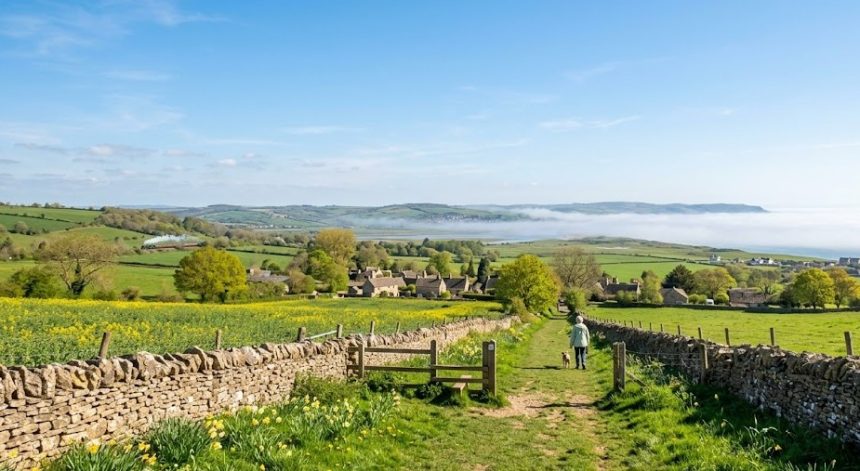
On Friday, 24 April, the UK is experiencing its brightest day of the week. Winds have dropped to light breezes, allowing temperatures in sheltered western spots like Chepstow, Shrewsbury, and Glasgow to feel significantly warmer than the official 16°C or 17°C readings.
However, this stability comes with a catch: without cloud cover to act as a blanket, the heat absorbed during the day is escaping rapidly into space after sunset, a process known as radiative cooling.
A chilly start once again on Friday with some frost in prone rural spots.
Areas of fog and low cloud quickly lifting and burning back to North Sea coasts through the morning, leaving a warmer and sunnier picture for most by midday ☀️
Blustery easterly winds in the southwest 🌬️ pic.twitter.com/ENGFWW0END
— Met Office (@metoffice) April 23, 2026
Which UK Regions Face the Biggest Temperature Swings?
The weather isn’t “one size fits all” this weekend. We are seeing a distinct geographical split:
- The “Sunny West”: Regions like Wales, Cornwall, and Northern Ireland will see the most consistent sunshine, with Belfast likely hitting 17°C on Friday.
- The “Foggy East”: Areas from Hull to Norwich are battling “Haar” or sea mist. This low cloud, blown in from the still-chilly North Sea, may linger until mid-morning on both Friday and Saturday, keeping coastal highs capped at a bracing 11°C.
- The “Frosty Rural North”: While daytime temperatures in the Scottish Highlands and Cumbrian Fells are pleasant, overnight lows are plummeting toward 2°C or 3°C, bringing a late-season risk of rural frost.
Why are Commuters Facing a “Double Jeopardy” on Friday?
The weather is playing a supporting role in a major travel disruption event. Friday, 24 April, marks the final day of a significant RMT London Underground strike.
While the weather is “perfect” for walking or cycling, Transport for London (TfL) has warned that fog patches in the Home Counties and East London (affecting the M11 and A12 corridors) may slow down those opting for cars or buses.
Furthermore, seven major East London bus routes, including the 8, 25, and 205, remain on strike today, making the clear, dry weather a vital “saving grace” for those forced to walk between transport hubs.
Is the Dry Spell Hitting UK Agriculture and Water Levels?
Despite the pleasant conditions, the UK Environment Agency and Defra are monitoring the situation with concern. Following a historically dry start to 2026, the lack of significant rainfall this April is putting pressure on groundwater recharge.
- Drought Risk: A recent GOV.UK report warned that without a wet spring, parts of Cambridgeshire and Bedfordshire could face formal drought status by summer.
- Pollen Counts: The current dry, sunny window has triggered a “Pollen Spike.” Birch and ash trees are releasing high concentrations of allergens. The National Pollen and Aerobiology Research Unit suggests hay fever sufferers in the Midlands and South East will experience peak symptoms this weekend.
- Farming: While the dry soil allows for the sowing of spring crops, the lack of moisture means germination could be delayed unless irrigation is used, a costly measure for many smallholders.
What Does the Official Forecast Say for Saturday?
According to the latest Met Office 10-day trend analysis, Saturday, 25 April, will see a slight “clouding over” from the northeast.
- Morning: Any mist and fog in the east will burn off by 10:00 AM.
- Afternoon: Large parts of England and Wales will remain dry with sunny spells, though Scotland may see more “variable cloud.”
- Evening: Another dry, chilly night follows, though slightly less cold than Friday night as cloud cover increases.