
The latest Met Office weather forecast snow update has placed much of the UK on high alert, with forecasters warning that up to 11 inches (30cm) of snow could fall in some areas as a powerful Arctic northerly blast takes hold.
With temperatures dropping as low as -4°C and gale-force winds expected, the wintry conditions are likely to cause widespread disruption during the busy New Year period.
What Is the Met Office Warning the UK About?
The Met Office says the UK is entering a period of severe and persistent cold weather, beginning on Thursday and continuing through the weekend.
A strong northerly wind is expected to drag freezing Arctic air across the country, turning rain showers increasingly into snow.
In an official update, the Met Office said: “Showers will turn increasingly to snow through Thursday as a strong, perhaps locally gale force northerly wind sets in.”
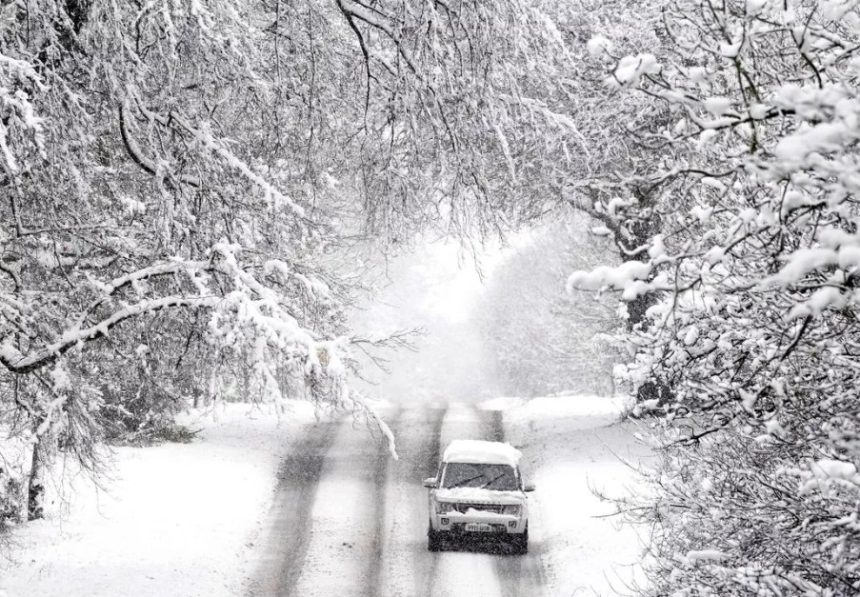
Initially, snow is expected to settle mainly on higher ground. However, by Thursday evening and into Friday morning, accumulations are forecast to build even at lower levels.
In some places, several centimetres of lying snow could form rapidly, while upland routes and hills may see much deeper cover.
Which Parts of the UK Are Likely to See the Heaviest Snow?
Scotland is expected to bear the brunt of the wintry weather. The Scottish Highlands and Aberdeenshire are forecast to see the most persistent and heavy snowfall, raising concerns about road safety and potential disruption to Hogmanay celebrations.
Further south, snow showers are expected to spread across much of England as the cold air pushes down from the north.
The Met Office says snow could reach as far south as Kent by Saturday, with weather maps also indicating flurries across London.
In England, the most significant snowfall is currently expected across parts of the East Midlands, including Lincolnshire and Leicestershire, before moving eastwards towards Norfolk overnight into Sunday.
Subtle shifts in wind direction mean that snowfall totals could vary significantly from one area to another, with some communities seeing much heavier accumulations than nearby locations.
How Cold and Windy Will It Get?
Daytime temperatures are forecast to struggle, with some areas remaining below freezing even during daylight hours. The Met Office warns that gale-force northerly winds will worsen conditions, particularly along exposed coastlines.
Gusts of up to 60mph are expected along the North Sea coast, including parts of Humberside. These strong winds are likely to cause drifting snow, reducing visibility and making roads especially treacherous from New Year’s Day evening into Friday.
Will There Be Travel Disruption Over the New Year?
Yes. The Met Office has already issued a weather warning for snow and ice covering New Year’s Day and Friday, warning of difficult travel conditions at a time when roads, train stations and airports are typically busy.
Forecasters say delays and cancellations are likely, particularly across Scotland, where snowfall will be heaviest. Snow drift and icy surfaces could also affect rural routes and higher roads across northern England.
While no additional warnings have been issued yet, the Met Office has stressed that new alerts could still be announced, especially for Saturday.
What Advice Is the Met Office Giving to the Public?
The Met Office is urging people to plan ahead and avoid unnecessary travel where possible. Drivers are advised to allow extra time for journeys and ensure their vehicles are winter-ready.
In its guidance, the Met Office said: “Snowy, wintry weather can cause delays and make driving conditions dangerous… People cope better when they have prepared in advance for the risk of power cuts or being cut off from services.”
Households, particularly in rural areas, are encouraged to be prepared for possible short-term disruption, including power outages or difficulty accessing local services during heavy snowfall.
How Unusual Is This Amount of Snow for the UK?
While snow is not uncommon during UK winters, accumulations of 20–30cm are considered significant and are usually limited to high ground.
Forecasters say this event sits at the upper end of what is typical for early January, especially given the combination of heavy snowfall, strong winds and freezing temperatures.
The risk of drifting snow makes this weather system more disruptive than snowfall figures alone might suggest.