
The United Kingdom’s brief encounter with early summer has come to an abrupt and turbulent end. Following a record-breaking midweek peak where temperatures reached 26.6°C at Kew Gardens, a powerful Atlantic low-pressure system has asserted dominance over the British Isles.
For the weekend of Saturday 11 April and Sunday 12 April 2026, the Met Office warns of a “sharp shock” to the system, characterized by a transition from settled sunshine to squally rain, hail, and significant wind speeds.
Why Has the “April Heatwave” Vanished So Quickly?
The dramatic shift in conditions is the result of a “buckling” jet stream. Earlier this week, a southerly flow dragged warm air from the continent across the UK.
However, as of Friday’s weather, a cold front associated with a deepening low-pressure system in the mid-Atlantic has swept southeastwards.
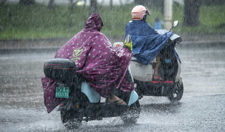
A wet and windy start to Saturday for many 🌧️
Rain will clear eastwards leaving a day of sunshine and blustery showers 🌦️
Feeling chilly in brisk winds 🌬️ pic.twitter.com/4b08Yq0rE3
— Met Office (@metoffice) April 10, 2026
This meteorological “reset” has seen temperatures dive by more than 10°C to 15°C in less than 48 hours. The current pattern is governed by a lingering low to the northwest, which is funneling a “mobile Atlantic flow” across all four nations.
This ensures that while the initial rainband cleared eastern England early Saturday, the atmosphere remains highly unstable, leading to the classic “April showers” but with significantly more intensity and wind energy than usual.
Which UK Regions are Facing the Worst Conditions?
The impact of this weekend’s weather is not uniform, with a clear northwest-southeast split in severity:
- Northern Ireland and Western Scotland: These regions are currently the “front line” for the Atlantic low. Residents are experiencing heavy, persistent showers and longer spells of rain. There is a verified risk of hail and thunder throughout Saturday and Sunday.
- The West Coast (Wales and South West England): Coastal gales are the primary concern here. Exposed headlands in Cornwall, Pembrokeshire, and Gwynedd are seeing gusts of 50–60mph, leading to hazardous conditions for small watercraft and high-sided vehicles.
- Northern England and the Midlands: Rain clearing early Saturday has been replaced by “bright intervals” but followed rapidly by heavy, squally showers. Higher ground in the Pennines and the Lake District may see temperatures drop low enough for transient sleet.
-
London and the South East: While this region remains the driest and brightest, it is far from the warmth of Wednesday. Winds remain “moderate to fresh,” and any sunshine will feel “chilly” compared to the 26°C recorded earlier this week.
The Official Outlook: Risks and Restrictions
Official UK bodies have issued several advisories to manage the transition from “Fool’s Spring” back to reality:
- The Met Office: Forecasters have highlighted that Sunday will be a “hit-and-miss” day. While some may see plenty of sunshine, others will be caught in thundery downpours. They urge the public to “stay weather aware,” particularly in the northwest, where the wind remains strongest.
- The Environment Agency: While widespread river flooding is not expected, Flood Alerts remain active for parts of Southern England. This is primarily due to high groundwater levels following an exceptionally wet February and the arrival of “Storm Dave” earlier in the month.
- National Rail & National Highways: Motorists on the M6, M74, and A1(M) are cautioned about sudden crosswinds. Rail passengers in the capital are facing a particularly difficult weekend, as the weather combines with ongoing London Tube closures to complicate regional travel plans.
How Will the Public Be Impacted This Weekend?
The weather shift is affecting several sectors of UK life:
- Travel and Commuting: Ferries across the Irish Sea and Minch may face delays due to Force 8 gales. On the roads, spray from heavy thundery showers is reducing visibility, particularly for those traveling to the Grand National at Aintree, where the going is currently “Good to Soft.”
- Energy Consumption: After a week of dormant heating systems, the National Grid expects a surge in demand as households across Scotland and Northern England face overnight lows of 4°C to 5°C, with rural spots potentially seeing a light frost.
- Agriculture and Gardening: The return of rain is a boon for farmers in East Anglia following a dry spell, but gardeners are warned that “strong gusty winds” on Sunday could damage early-blooming spring plants if not sheltered.
What is the Long-Range Forecast for Mid-April?
The unsettled theme is set to continue. Monday, 13 April, will bring a temporary reprieve with lighter winds, but by Tuesday, another system is expected to move in from the west.
“The dominant pattern for the next 10 days remains low pressure to the west. This means the northwest will likely remain the wettest and windiest, while the southeast sees the best of any drier, brighter interludes,” notes the Met Office long-range outlook.