
The weather forecast snow storm gripping the UK is set to worsen midweek, with fresh snowfall, strong winds and an intense blast of Arctic air expected to bring some of the coldest conditions seen in years.
Forecasters are warning that travel disruption, health risks and infrastructure strain are all likely as temperatures plunge towards the weekend.
This developing weather system is being closely monitored by national agencies, with updated warnings expected as conditions evolve.
What Is Driving This Sudden Snow Storm Across the UK?
Meteorologists say the snowstorm is being caused by a fast-moving northern weather system followed by a powerful high-pressure zone drawing in bitter Arctic air.
This combination is forcing cold air rapidly southwards while moisture-laden winds generate fresh snowfall.
According to the Met Office, this pattern is typical of severe winter events, where snow is quickly followed by dangerous cold and strong winds that worsen ground conditions.
A wide-ranging winter storm will produce great swaths of heavy snow, sleet, and treacherous freezing rain from the southern Rockies/Plains and Mid-South starting Friday and shifting toward the East Coast through Sunday. With a few days to go, the forecast will continue to evolve.… pic.twitter.com/1evm8lCfBp
— National Weather Service (@NWS) January 20, 2026
Met Office spokesperson: “A rapid shift to much colder air will bring snow showers, drifting snow and a significant wind chill, particularly across northern and higher-lying areas.”
How Much Snow Has Fallen and What Are Road Conditions Like?
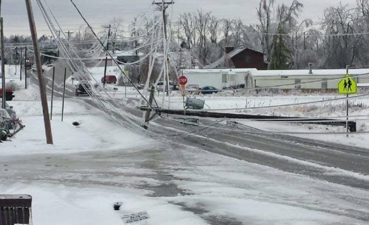
Overnight snowfall has already delivered around 5 to 8 centimetres (2 to 3 inches) of snow across parts of Scotland, northern England and higher elevations in Wales.
Many untreated side roads remain snow-covered, while even major routes are seeing compacted snow and ice during peak travel hours.
Local authorities have confirmed that gritting teams are working continuously, but blowing snow is undoing some of that progress. Even cleared roads can quickly refreeze as temperatures remain well below zero.
Why Are Strong Winds Making Travel More Dangerous?
As winds increase through Wednesday afternoon, visibility is expected to drop sharply in exposed areas. Gusts of up to 40mph are forecast in some regions, lifting loose snow and creating sudden white-out conditions.
This makes driving particularly risky, as conditions can change within minutes. The RAC has warned that braking distances are significantly longer on snow-covered roads and that stranded vehicles are a real concern in rural areas.
RAC winter travel advice: “Drivers should avoid unnecessary journeys during severe weather, as even short trips can become dangerous very quickly.”
Just How Cold Will It Get This Week?
This storm is not only about snow. The cold that follows is expected to be the most severe in nearly five years for parts of the UK.
After a sharp temperature drop on Thursday evening, overnight lows could fall to -15°C to -20°C in rural northern locations, with daytime temperatures struggling to rise above -10°C on Friday.
When wind is factored in, it could feel closer to -30°C or lower in exposed areas. These conditions dramatically increase the risk of frostbite and hypothermia, particularly for people spending extended time outdoors.
An Extreme Cold Weather Warning is expected to come into force from Thursday night through Saturday morning.
Who Is Most at Risk During Extreme Cold?
Health officials stress that older adults, young children and people with heart or respiratory conditions are especially vulnerable. Even healthy adults can be affected if exposed for too long without proper clothing.
The UK Health Security Agency has urged people to check on neighbours and family members, ensure homes are adequately heated, and avoid prolonged outdoor activity unless essential.
UKHSA guidance: “Severe cold can have serious health impacts. Planning ahead and limiting exposure can prevent avoidable illness and injury.”
When Will the UK Weather Improve?
Forecasters say conditions should slowly ease early next week. While mornings will remain frosty, daytime temperatures are expected to recover to just above freezing.
Winds will gradually weaken, reducing the risk of blowing snow and allowing transport networks to stabilise.
Although winter conditions will linger, the most dangerous phase of the storm is expected to pass by the end of the weekend.