
The United Kingdom is facing a stark mid-April meteorological shift as a series of low-pressure systems sweep across the country.
After a relatively settled start to the month following the disruption of Storm Dave earlier in April, the Met Office has confirmed that a “cloudy and damp” start on Wednesday, 15 April, will escalate into a significant weather event.
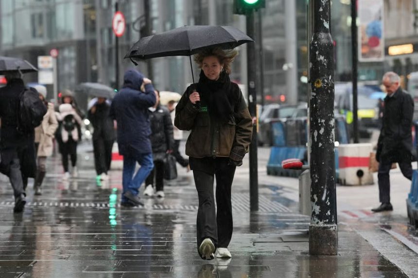
A band of heavy rain is currently tracking eastwards, set to be replaced by unstable atmospheric conditions on Thursday, 16 April, bringing a high risk of hail, thunder, and localised flooding.
Is ‘Washout Wednesday’ Set to Disrupt Your Travel Plans?
The primary weather event for Wednesday is a broad Atlantic frontal system. While the day began with persistent drizzle and overcast skies, the intensity of the rain is increasing as it moves from the West Midlands and Wales toward the East Coast.
No need to worry about a frost tonight 🌡️
Temperatures are going to be much milder overnight compared to this morning with most places in the double digits ⤵️ pic.twitter.com/Ks2WNzcS4b
— Met Office (@metoffice) April 14, 2026
The Met Office describes this as a “band of heavy rain pushing eastwards,” which is significantly reducing visibility on major transit routes. Commuters on the M1, M6, and A1(M) are already reporting spray-related delays.
Despite the precipitation, the air remains unseasonably mild, with “warm spells of sunshine” potentially breaking through in the wake of the rain, particularly in southern counties like Kent and Hampshire.
Which Regions Are Most at Risk of Flooding and Thunderstorms?
As the main rain band clears into the North Sea on Wednesday night, the focus shifts to a more “unstable” air mass arriving from the northwest.
- The Northwest & Scotland: Overnight into Thursday, showers will be “heaviest and most frequent” in these regions.
- The North & Northeast: On Thursday, 16 April, the atmosphere will become volatile. The Met Office has warned of “heavy showers with the risk of hail and thunder” for much of Northern England and Scotland.
- The South & Midlands: While these areas will see more “sunny spells,” they are not immune to the “bright and breezy” conditions that could bring sudden, sharp downpours that overwhelm urban drainage systems.
What Are Official Sources Saying About Potential Disruptions?
The Environment Agency (EA) has been proactive in its monitoring, particularly as the UK recovers from one of the wettest starts to a year on record.
“Groundwater flooding remains a significant concern in the Alton area, Great Shefford, and parts of the Salisbury Plain.
While we are seeing a brightening trend, the saturation of the ground means any additional heavy rainfall could lead to immediate surface water issues.” Environment Agency Update, 15 April 2026
Additionally, National Highways has issued a reminder to motorists to check their tyres and wipers, as the combination of “warm sunshine” and “sudden hail” creates hazardous, rapidly changing road conditions.
Transport for London (TfL) has not reported weather-related closures yet, but they remain on standby for drainage issues on the District and Bakerloo lines.
How Will This Volatile Weather Impact Your Daily Commute and Business?
The “bright and breezy” forecast for Thursday carries a deceptive risk. While the mercury may hit a pleasant 15°C or 16°C in London and the Southeast, the “risk of hail and thunder” poses specific challenges:
- Agriculture and Gardening: The threat of hail is a concern for early spring blooms and fruit growers in the Vale of Evesham and Kent.
- Outdoor Trade: For hospitality businesses relying on the “warm spells,” the unpredictability of thundery showers may force customers indoors at short notice.
- Energy and Power: Isolated thunder and lightning strikes in the North could lead to localised power fluctuations, though widespread outages are not currently expected.
When Can We Expect a Return to More Settled Spring Weather?
The immediate outlook suggests a “sunshine and showers” regime will persist through the end of the week.
- Friday, 17 April: A brief “bright” start for most of the UK, providing a window for outdoor activities. However, another system is already being tracked by the Met Office, expected to bring rain to western areas (Northern Ireland and Western Scotland) by Friday evening.
- The Weekend: Saturday appears to be a repeat of the “rain followed by showers” pattern, though long-range ensemble models suggest high pressure may build from the northeast by Sunday, 19 April, offering a “fine and dry” conclusion to the week.