
The UK is bracing for a sharp plunge in temperatures later this month, as icy conditions look set to sweep across the country, from the rugged Highlands of Scotland down to the rolling hills of Devon.
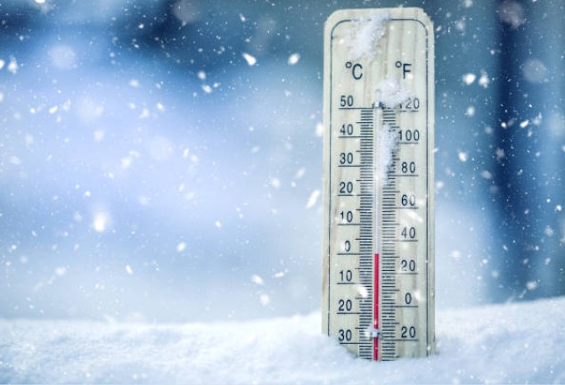
After weeks of mild, damp weather, winter is making an early and dramatic entrance. Latest WX Charts reveal the mercury could tumble as low as -5°C, painting the nation in shades of icy blue.
Arctic Chill Incoming
The cold snap, predicted to tighten its grip by mid-November, will see frost and biting winds spreading widely.
Inverness-shire, Scotland’s largest county by land, is expected to take the hardest hit, plunging to -5°C. Northern Scotland won’t be spared either, with temperatures hovering around -4°C and -3°C by the 17th.
WX Charts indicate that the freezing air mass will push its way southward, stretching from Sutherland to Devon. Around midnight on Monday, November 17, most of Britain will be feeling the sting.
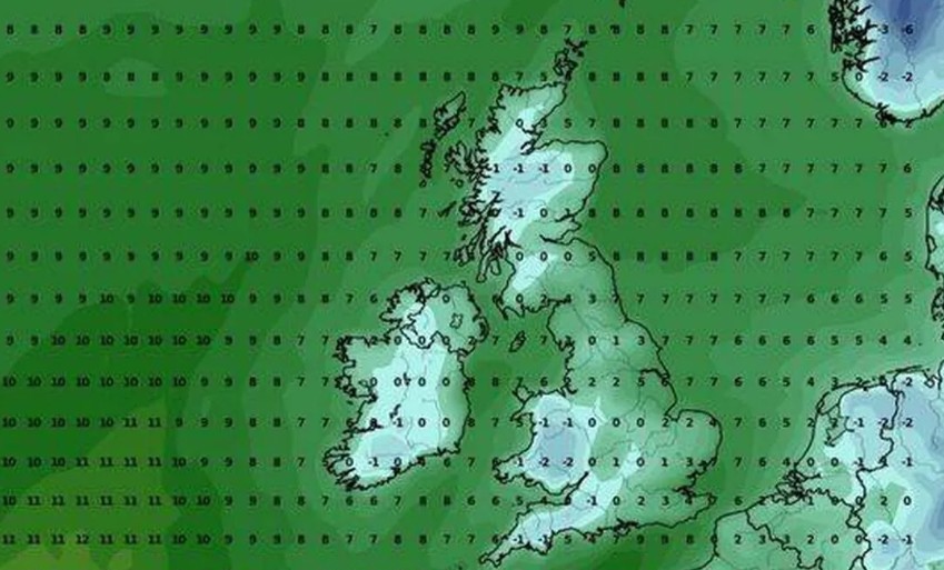
Early risers will wake to a frostbitten morning, with -5°C to -3°C forecast across the north, -2°C to -1°C in parts of northern England, around 0°C in Devon and Wales, and a nippy -1°C in Somerset.
Britain’s coldest November on record dates back to 1919, when average temperatures sank to just 2.3°C.
On November 14 that year, Braemar in Aberdeenshire recorded a staggering -23.3°C, the lowest November temperature ever logged in the UK. The Met Office still recognises that as an unbroken record.
What does the Met Office say?
The national weather agency’s long-range outlook for 9–18 November hints at “changeable and at times unsettled weather”, dominated by low pressure.
“Changeable and at times unsettled weather is likely to continue into the start of this period, with low pressure dominating the UK.
This means further showery outbreaks of rain at times, though it is likely that western areas will be wettest at first.
There could also be some overnight fog, which could be slow to clear throughout the day.
A transition to a less unsettled weather pattern becomes increasingly probable from around the 11th or 12th of the month, making drier weather increasingly common, with winds turning south easterly or easterly.
Any rain or showers is more likely to be focused towards the east. Temperatures most likely to be around average through the period, particularly at first, and probably overall.”
In short, expect a mix of frosty mornings, patchy fog, and a gradual move toward drier, colder air.
28 Counties Set to Shiver
WX Charts list the following as the coldest counties likely to face the deep freeze:
- Aberdeenshire
- Ayrshire
- Banffshire
- Berwickshire
- Fife
- Inverness-shire
- Lanarkshire
- Midlothian
- Morayshire
- Perthshire
- Ross-shire
- Stirlingshire
- Sutherland
- Cumbria
- Derbyshire
- Devon
- Durham
- Lancashire
- Northumberland
- Somerset
- Westmoreland
- Carmarthenshire
- Ceredigion
- Conwy (County Conwy)
- Denbighshire
- Gwynedd
- Powys
- Wrexham
Meteorologists are urging people to prepare for slippery roads, icy pavements, and frosty mornings. Those in rural and northern areas should brace for the worst of the chill.
As one meteorologist put it, “November’s mild start was deceptive. The cold is coming, and it’s coming fast.”
With UK weather turning sharply wintry, it might be time to dig out the gloves, top up the heating, and brace for a proper British cold snap.