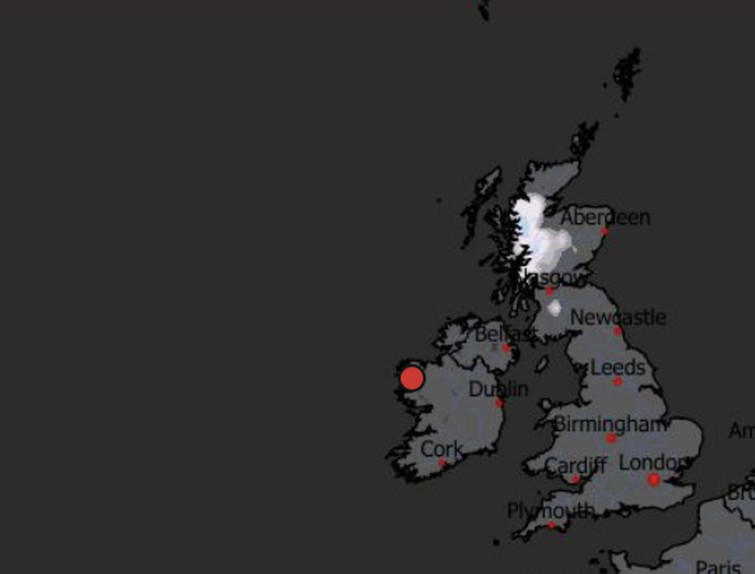
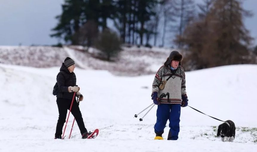
The latest UK weather forecast suggests winter could be about to make a dramatic entrance, with new snow maps indicating that parts of the country may see snowfall for up to nine days in a row.
While much of the UK is expected to remain cold but largely dry, Scotland appears firmly in line for a prolonged wintry spell as an Arctic blast moves in just before Christmas.
Forecasters say this developing weather pattern could deliver some of the most sustained snowfall seen in recent festive periods, at least north of the border.
Where is snow most likely to fall?
According to the latest snow charts from WXCharts, based on MetDesk data, north-west Scotland is expected to be hardest hit.
Snowfall is forecast to begin around December 20, with cold air remaining in place long enough for repeated snow showers to develop. The areas facing the highest risk include:

- The Scottish Highlands
- The Cairngorms
- The Grampian Mountains
In these regions, snow could fall frequently and settle, particularly on higher ground. This raises the likelihood of travel disruption, icy roads and challenging conditions for rural communities.
Scotland is at the centre of the Arctic blast
Weather models show Scotland sitting closer to the source of Arctic air pushing south from the north. As Atlantic systems weaken, colder air is able to hold its ground, allowing precipitation to fall as snow rather than rain.
This setup means Scotland is far more likely to experience wintry conditions, while England, Wales and Northern Ireland remain on the milder edge of the system, cold, but mostly dry.
Will snow spread further before Christmas Eve?
Snow is forecast to remain fairly centralised over north-west Scotland between December 20 and 23. However, forecasts suggest the wintry weather could spread further as Christmas draws closer.
By Christmas Eve, snow showers may reach central and eastern Scotland, with cities such as Glasgow and Aberdeen potentially seeing flakes. Snow is expected to continue in parts of Scotland on Christmas Day, before becoming more widespread on Boxing Day.
Counties at risk during the festive period
Several Scottish counties are highlighted as being most at risk of snowfall between Christmas Eve and Boxing Day:
- Highland
- Aberdeenshire
- Moray
- Perth and Kinross
- Angus
Higher elevations within these areas are especially vulnerable to settling snow, overnight frost and icy roads.
What does the Met Office say about the Christmas weather outlook?
The Met Office long-range forecast for December 19 to December 28 suggests a gradual shift towards more settled conditions, particularly in the northern parts of the UK.
It says: “Showers or longer spells of rain are likely to continue at first for many parts of the country, perhaps heavy at times, but gradually over the weekend the weather is expected to become more settled.
Scotland and Northern Ireland are likely to see this change first, with spells of rain perhaps slower to clear further across the south.”
Looking ahead to the week beginning Christmas Day, the Met Office adds that “high pressure is expected to become more widely established”, bringing calmer weather overall, alongside colder temperatures, overnight frosts and morning fog.
White Christmas outlook across the UK
Despite the eye-catching snow maps, a UK-wide white Christmas still looks unlikely. While Scotland stands a strong chance of seeing snow on the ground, most of England, Wales and Northern Ireland are expected to remain snow-free.
The last widespread white Christmas across the UK was in 2010, and current forecast data does not suggest a repeat this year.
Impact on travel and daily life
A prolonged cold spell combined with snowfall could lead to:
- Slower journeys on untreated rural roads
- Possible rail disruption in snowy areas
- Icy pavements and early-morning frost
- Increased fog is affecting visibility
People travelling in northern Scotland are advised to check official weather forecasts regularly as Christmas approaches.
The overall Christmas weather picture
For much of the UK, Christmas is shaping up to be cold, calm and crisp, rather than wet or stormy. Frosty mornings and fog patches are likely where skies remain clear overnight.
For parts of Scotland, however, the festive season could arrive with deep snow, freezing temperatures and classic winter scenes, making this one of the more wintry Christmas periods in recent years.


