
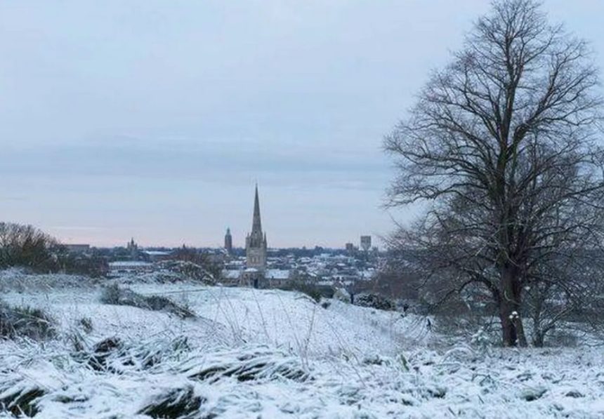
A frigid Arctic blast is forecast to sweep across Britain in early January, bringing snow to large parts of England, Wales, and Scotland.
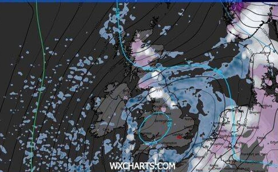
According to the latest WXCHARTS.COM weather maps, snowfall could begin in northern regions from New Year’s Day, spreading southward to cover approximately 600 miles of the UK by Monday, 5 January.
Which Areas Are Most at Risk of Snow?
Forecast maps from WXCHARTS.COM suggest that snow could stretch roughly 600 miles across the UK, from Folkestone in Kent to Dunbeath, Caithness in northern Scotland.
However, snow is not expected to be uniform: some regions may escape the worst of it.
England:
- Snow depth could range between 1cm and 6cm south of Newcastle.
- Cities predicted to see snowfall include: London, Reading, Ipswich, Colchester, Norwich, Cambridge, Peterborough, Northampton, Derby, Nottingham, Leicester, Sheffield, Doncaster, Leeds, York, Hull, Middlesbrough, Durham, and Newcastle.
Scotland:
- Snow depths may vary from 1cm to 13cm, particularly where the southeastern Highlands meet Aberdeenshire and Perth & Kinross.
- Major cities likely affected: Glasgow, Stirling, Inverness, and Perth.
- Aberdeen and Dundee along the east coast may remain snow-free.
- The heaviest accumulation is expected in the Cairngorms National Park and adjacent mountainous regions.
Wales:
- Northern and central Wales could see light snow, around 1cm, though major cities like Cardiff, Newport, Swansea, and Wrexham are likely to remain clear.
Northern Ireland is not expected to see snowfall during this period.
What Is Causing the Arctic Blast?
The Met Office explains that the cold weather is being driven by a combination of high pressure over the North Atlantic and cold northerly air moving southwards.
In its extended forecast for 29 December to 7 January, the Met Office stated: “High pressure is likely to dominate across the UK through to the end of the year, centred to the west over the North Atlantic.
This will maintain relatively settled conditions initially, with occasional showers along exposed coasts.
Towards the first weekend of January, high pressure is expected to shift, allowing for more changeable conditions.
With cold air near the UK, some showers could bring wintry hazards. Temperatures will likely be near or slightly below average.”
This combination of settled conditions followed by colder northerly winds sets the stage for snow in early January.
Historical Perspective
While these snowfall levels are not extreme, they could still disrupt daily life. Southern England experienced similar conditions in 2018, with light snowfalls reaching up to 6cm.
In Scotland, the Highlands saw heavier snow during 2021, particularly in the Cairngorms, where depths reached double digits.
Northern Wales has also experienced light snow in past winters, especially around Snowdonia, though cities often remain unaffected.
How Will This Affect People in the UK?
Commuters in northern England and Scotland may face slippery roads and potential rail delays. Rural and mountainous communities should prepare for heavier snow accumulations. Even in cities with only light snowfall, icy pavements and frost could pose hazards.
Residents are advised to check local forecasts regularly and take precautions, particularly when travelling early in the morning or late at night.