
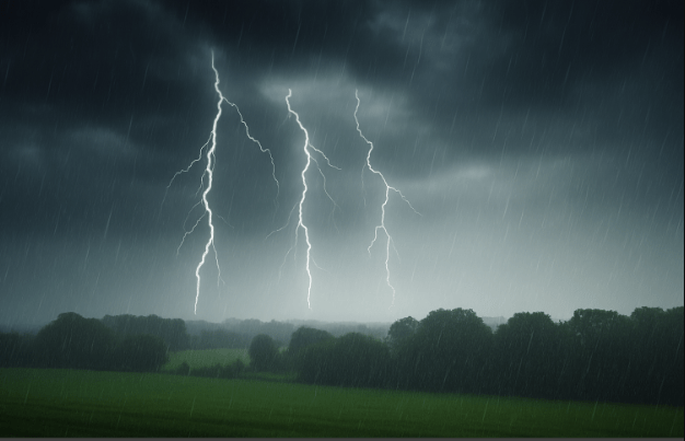
Perth weather: Wild Storms, Soaking Rain and Strong Winds Set to Lash Western Australia
Perth is bracing for a drenching, with intense downpours and whipping winds on the cards this Wednesday, as much of Western Australia prepares for a bout of wintry chaos.
The Bureau of Meteorology has warned residents across the State to bunker down. A strong wind warning is in effect for coastal areas, including Geraldton, Lancelin, Perth, Bunbury, Geographe, Leeuwin, Albany, and Esperance.
“An afternoon thunderstorm is expected to bring up to 35mm of rain and 30km/h winds.”
It’s set to be a messy one. Rain, thunder and chilly gusts will make their presence felt well into Thursday. Morning showers could dump a further 15mm of rainfall across the metro area.
The week won’t end quietly either. Another cold front is looming, ready to strike on Sunday with an estimated 20mm of rain. So, if you’re hoping for a dry weekend – think again.
“It follows a run of colder days, including a low point of 2.2 degrees on Monday which saw Bluff Knoll get the first snow fall of the season.”
Despite the relentless grey skies, July’s rainfall figures are still trailing behind. The city’s monthly total sits at 105.2mm – well short of the average for this time of year.
Annual rainfall for 2025 stands at 329mm. It’s been a cool, wet winter – just not wet enough by typical standards.
Locals are advised to stay alert, keep umbrellas close, and avoid unnecessary travel during peak storm periods. Coastal residents, in particular, should remain cautious as winds intensify.
As the weather turns wild, Perth continues to ride the rollercoaster that is a classic Western Australian winter. Expect more wet, more wind – and definitely, more thunder.