Heatwave Ends With Flood Fears Before a Breezy Weekend Break
It’s been a rollercoaster week for the Northeast US, and the ride isn’t over just yet.
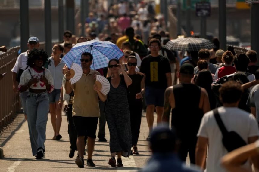
First came the heatwave. Relentless. Sticky. Unbearable at times. But just as residents along the I-95 corridor were adjusting to the muggy air, a new twist entered the forecast: flash floods.
“A cold front will slowly work its way across the Northeast through Thursday while interacting with the humid air that has created sweltering conditions in the first half of the week,” forecasters explained.
“This combination of ingredients will help generate numerous showers and storms that could deliver drenching rainfall in spots.”
Cities from Hartford to New York, Philadelphia to Washington D.C., could face localised flash flooding. The heavy downpours may linger long enough in some areas to trigger travel delays, especially during the Thursday evening rush.
Commuters are advised to allow extra time and to steer clear of roads covered in water.
“As little as 1 foot of water can float a car or small SUV,” meteorologists reminded. A moment’s mistake could turn dangerous.
But don’t pack away your weekend plans just yet. There’s good news on the horizon.
Behind that soggy cold front is a refreshing shift in the air. Drier, cooler, and far more agreeable.
“Humidity will be noticeably lower as high pressure draws drier air into the region behind the cold front,” the report stated. Gone will be the tropical moisture. What replaces it? Comfortable temperatures and a taste of early autumn.
Saturday will see highs hovering in the mid-70s for Boston, and low 80s in NYC and D.C., a few degrees shy of the usual August average. Sunday will follow suit, but without the stickiness. Mornings will feel especially crisp, with lows dipping into the 50s across New England.
It’s a tale of two halves: from oppressive heat to drenching rain, ending with the kind of weekend that begs for park strolls and open windows.