
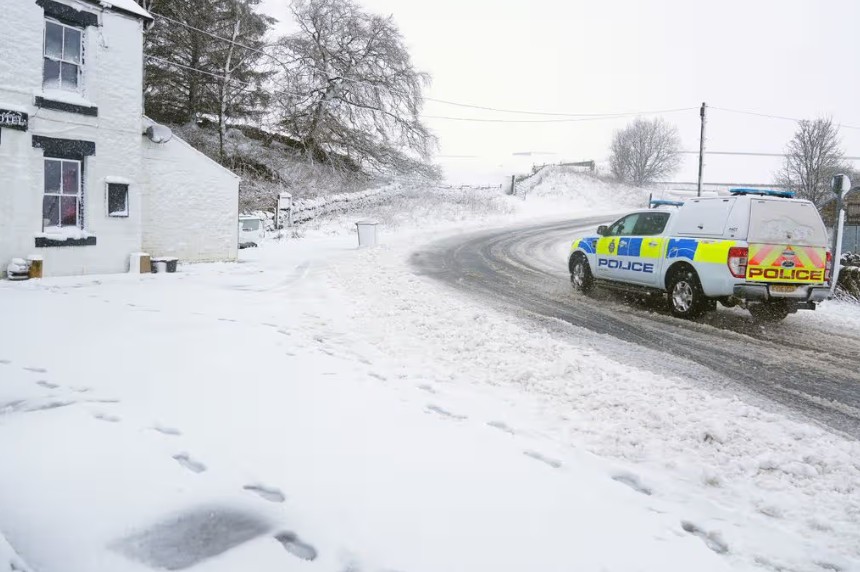
A widespread snow forecast has been issued across the UK this Friday, with temperatures feeling as cold as -8C, the Met Office reports.
A bitter southeasterly wind, gusting up to 70mph in parts of Scotland, will make the chill even more severe. Snow is expected to reach as far south as the Midlands, with the heaviest flurries in Cumbria and the Peak District.
Where Will Snow Fall Across the UK?
Snow is predicted across a broad swathe of the UK. According to the latest Met Office maps:
- North: Aberdeenshire and the Scottish Highlands
- Central England: Staffordshire, Derbyshire, and parts of the Peak District
- Northwest: Cumbria (heaviest snow expected by 9am Friday)
Meteorologists at Metdesk confirm that these snow patterns align with the Met Office forecast, with the wintry conditions potentially arriving earlier than Friday, possibly even later today.
“Rather cloudy and breezy with some rain and hill snow lingering in the northeast, whilst showers give way to more persistent rain towards the southwest. Some brighter breaks are developing elsewhere,” the Met Office noted on its website.
How Cold Will It Feel and Why?
While actual air temperatures will hover just above freezing, wind chill will make it feel much colder in exposed areas.
The southeasterly wind will batter Scotland and northern England, with gusts reaching 70mph, increasing the risk of icy patches on roads and pavements.
Ice is already a concern following Storm Chandra earlier this week. Temperatures plunged below freezing on Wednesday in parts of Essex, including near Braintree, causing slippery conditions and minor travel disruption.
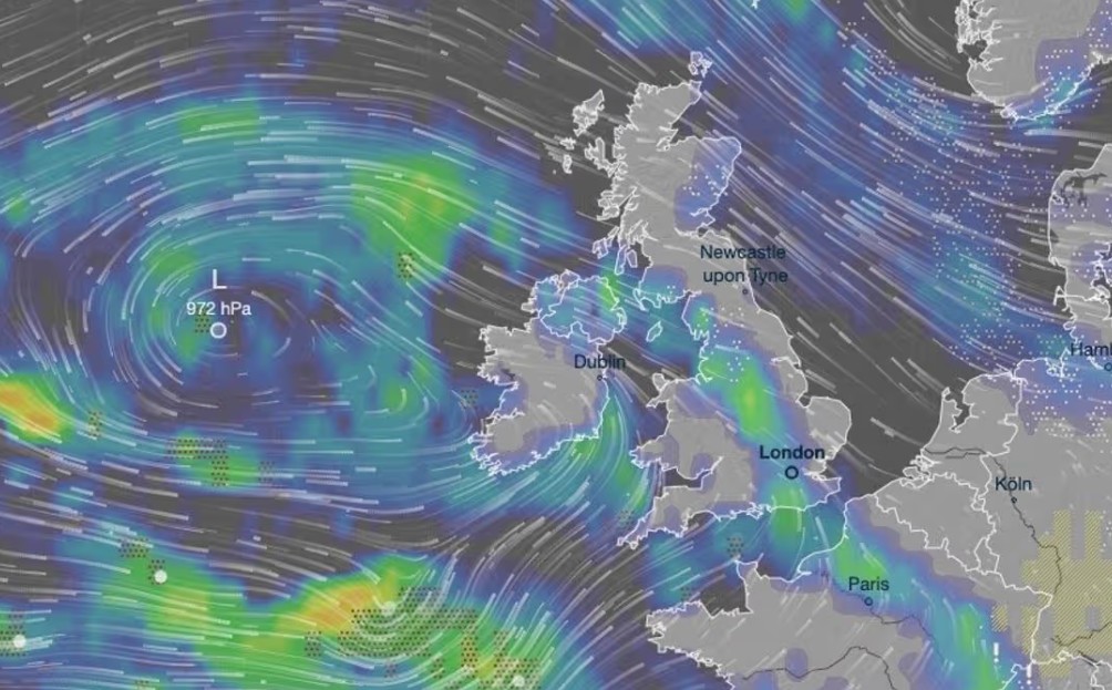
What About Rain and Flood Risks?
Rain moving in from the southwest today will hit Devon and Cornwall hardest, prompting a Yellow Weather Warning. Forecasters warn that heavy rainfall could worsen flooding on already saturated ground.
Matthew Lehnert, Chief Meteorologist at the Met Office, said: “10 to 15mm of rain is likely quite widely, with some areas, particularly towards the south coast, seeing up to 25mm.
The rain will fall onto already saturated ground, compounding the impacts of Storm Chandra. We encourage people to stay up to date with forecasts and follow advice from emergency services and local authorities.”
The ongoing flood risk is particularly high along major rivers, including:
- River Ouse, York
- River Wye, Derbyshire
- Lower Stour, Dorset (Severe flood warning in effect; residents at Iford Bridge Home Park were evacuated yesterday)
What Does This Mean for Travel and Daily Life?
Commuters across northern England, Scotland, and parts of the Midlands should prepare for:
- Snow-covered roads and icy pavements
- Disrupted train and bus services, especially in rural areas
- Flood warnings along rivers and low-lying streets
Drivers are advised to check Highways England updates and adjust travel plans accordingly. Schools in affected areas may also face closures if conditions worsen.