
The United Kingdom is facing a brutal atmospheric “U-turn” as an Arctic maritime airmass sweeps across the country, bringing a premature end to the brief spring warmth.
Following a period where temperatures teased the mid-20s, the Met Office has confirmed that a significant “plunge” is underway.
Meteorologists are now forecasting overnight lows to hit a bone-chilling 5°C in northern territories, with late-season snowfall expected to blanket the Scottish Highlands.
This sudden shift poses an immediate threat to the UK’s agricultural sector and is set to test the resilience of the national transport infrastructure during a busy post-bank holiday week.
Why is the UK Facing a Sudden Arctic Plunge in May?
The current weather shift is driven by a “meridional flow”, a pattern where the jet stream buckles, allowing frigid air from the Arctic Circle to be pulled directly south across the British Isles.
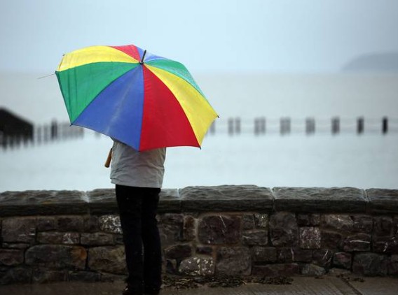
While Monday, 4 May 2026, began with a murky and overcast start for much of England, this was merely the “calm before the storm.”
As a weak cold front sinks southwards, it is being chased by a high-pressure system positioned over the Atlantic, which acts as a funnel for northerly winds.
A dull and damp start to Bank Holiday Monday, but brightening up with some sunshine in places ⛅
The risk of heavy showers returning to southern parts of England and Wales 🌦️ pic.twitter.com/kY2YwARuUV
— Met Office (@metoffice) May 3, 2026
This “Arctic Gate” is responsible for the dramatic 15°C temperature drop expected over the next 48 hours. For many in the UK, the transition from “t-shirt weather” to “winter coats” will occur almost overnight.
Which UK Towns and Cities are Most at Risk of Frost and Snow?
The “geographical lottery” of this cold snap means the North will bear the brunt of the freeze, though no part of the UK is entirely exempt.
- The Scottish Highlands & Grampians: These areas are under a high-probability alert for snow on Tuesday and Wednesday. Towns like Aviemore and Inverness are preparing for significant accumulations on higher ground.
- Northern England & The Pennines: Cities such as Newcastle, Durham, and Sheffield will see temperatures plummet to near-freezing, with local authorities on standby for grit spreading.
- The Midlands & Wales: A “murky and grey” transition on Monday will lead into a clear, sharp frost by Tuesday night. Birmingham and the Cotswolds are particularly vulnerable to ground frost.
- Southern England & London: While the south will avoid the snow, the “wind chill factor” will make London feel closer to 4°C during the early morning commute on Wednesday.
How Will the -5°C Freeze Impact UK Transport and Infrastructure?
The Department for Transport (DfT) and National Highways have issued advisories regarding “hazardous driving conditions.” The primary concern is not just the cold, but the “showery outbreaks” of rain on Monday night freezing over as the Arctic air arrives on Tuesday.
- Rail Networks: Network Rail is monitoring track temperatures. Sudden drops can cause rails to contract, leading to potential signaling faults or speed restrictions on the East Coast Main Line.
- Road Safety: Surface water from Monday’s rain will likely turn to black ice in rural parts of Scotland and Northern England. National Highways suggests motorists carry emergency kits, including blankets and de-icer.
- Aviation: While major hubs like Heathrow and Manchester Airport remain fully operational, de-icing protocols are being ramped up for early morning departures.
What are UK Authorities Saying About the Cold Snap?
Verified statements from government bodies emphasise caution and preparation:
- The Met Office: Senior meteorologist Greg Dewhurst warned: “Tuesday night into Wednesday will be the peak of the freeze. We are looking at -5°C in sheltered glens in Scotland, and even the south could see a rare May frost.”
- The NHS: Health officials have issued a reminder for vulnerable citizens to keep homes heated to at least 18°C. The sudden drop in temperature can exacerbate cardiovascular and respiratory conditions.
- The Environment Agency: While the focus is on the cold, groundwater flood alerts remain active for parts of West Berkshire (specifically Great Shefford), as the ground remains saturated from previous rainfall.
Is This May Snow Signal a Long-Term Trend or a Freak Event?
Climate analysts suggest that while May snow is rare, it is not unprecedented. However, the intensity of this specific Arctic plunge, coming so closely after record-breaking spring warmth, is a classic symptom of “weather whiplash” associated with a destabilised polar vortex.
Data from the UK Centre for Ecology & Hydrology suggests that such fluctuations are becoming more frequent. For the UK’s biodiversity, this “false spring” followed by a hard freeze can be catastrophic, potentially killing off early blossoms and impacting the year’s fruit harvest.
What is the Long-Range Forecast for the Rest of May?
As we move toward mid-May, the Met Office long-range forecast (8 May – 17 May) suggests a continuation of this “unsettled” theme.
-
High Pressure Returns: There are early signals that high pressure may build from the west toward the end of the month, which would finally bring more settled, warmer conditions to the UK.
-
The “North-South Divide”: Rainfall is expected to be more persistent in the north and west, while the south may see the return of “above average” temperatures by late May.