
UK weather forecasts are raising fresh concern after weather maps turned bright orange, signalling a rare and potentially dangerous freezing rain event expected to affect parts of Britain later this month.
According to the latest modelling, parts of the UK could see freezing rain in the early hours of Monday, December 30, a phenomenon seldom experienced in this country but capable of causing major disruption when it occurs.
Why Are UK Weather Maps Showing Bright Orange Warnings?
New charts from WXCharts, based on MetDesk data, highlight an elevated risk of freezing rain along the English-Welsh border, with Herefordshire and Shropshire most exposed.
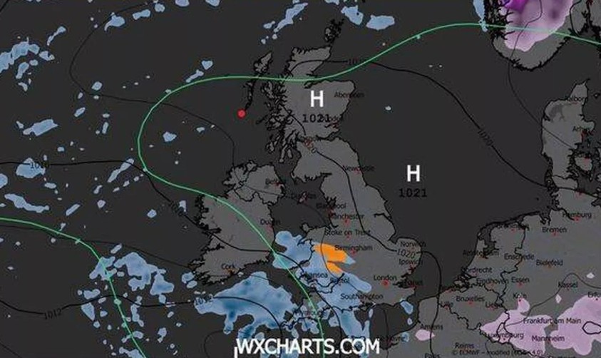
The bright orange shading does not mean extreme weather nationwide. Instead, it signals a high-impact localised event, one that forecasters monitor closely due to its unusual nature in UK weather patterns.
What Is Freezing Rain and Why Is It So Dangerous?
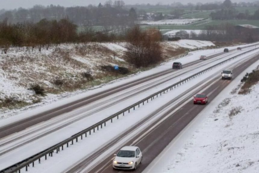
Freezing rain looks like ordinary rainfall but behaves very differently once it reaches the ground. The rain freezes instantly on contact with surfaces that are already below zero, creating a clear and extremely slippery layer of ice.
The Met Office warns that freezing rain can be more disruptive than snow.
In a statement, it said: “Freezing rain is more common in other parts of the world, for example, in the USA, where weather systems produce a lot of freezing rain.
These are called ice storms, and if enough glaze collects on trees or power lines, the weight of the ice can cause them to break and can result in disruption on a large scale.”
Because the ice is transparent, it can be difficult to spot, increasing the risk of road accidents and falls.
How Does Freezing Rain Form in UK Weather Conditions?
The conditions needed for freezing rain are highly specific, which is why it is rarely seen in the UK. Precipitation usually begins as snow or ice high in the atmosphere.
As it falls, it melts into rain while passing through a warmer layer of air. Just before reaching the ground, it drops through a thin layer of freezing air, becoming “supercooled”.
When these droplets hit roads, pavements, trees or power lines, they freeze immediately, forming a smooth coating of ice.
The Met Office explains: “The conditions needed for freezing rain are quite specific and we don’t see this phenomenon very often in the UK.
It can produce striking effects, as the raindrop spreads out momentarily across the surface before it freezes.”
Which Parts of the UK Are Most Likely to Be Affected?
Forecast data available in mid-December suggests the highest risk lies across western England near the Welsh border, particularly rural areas of Herefordshire and Shropshire.
The risk is greatest during the early morning when ground temperatures are lowest.
Even short-lived freezing rain can make untreated roads and pavements hazardous within minutes.
How Does This Fit Into the Wider UK Weather Forecast?
The Met Office’s long-range outlook from December 23 to January 1 shows a broader shift towards colder conditions across the UK.
High pressure is expected to build to the north, while low pressure moves away to the south, drawing in colder easterly winds over the Christmas period.
Temperatures are forecast to fall below seasonal averages, with frost becoming more likely, particularly in northern regions where winds are lighter.
While much of the country should stay dry, wintry showers remain possible in eastern and southern areas, especially over higher ground.
Towards the New Year, weather systems may allow wetter conditions to return in parts of the UK.
What Impact Could Freezing Rain Have on Daily Life?
Freezing rain can quickly disrupt travel and infrastructure. Roads may become impassable, airport runways can turn dangerously slick, and ice build-up on trees or power lines increases the risk of power cuts.
Previous UK incidents, although rare, have led to school closures, traffic collisions and delays across road and rail networks.