
As the UK enters the middle of March, the weather remains a focal point for millions planning their weekend activities.
The Met Office has released a detailed forecast for Saturday, 14 March, and Sunday, 15 March, indicating a stark divide between the North and the South.
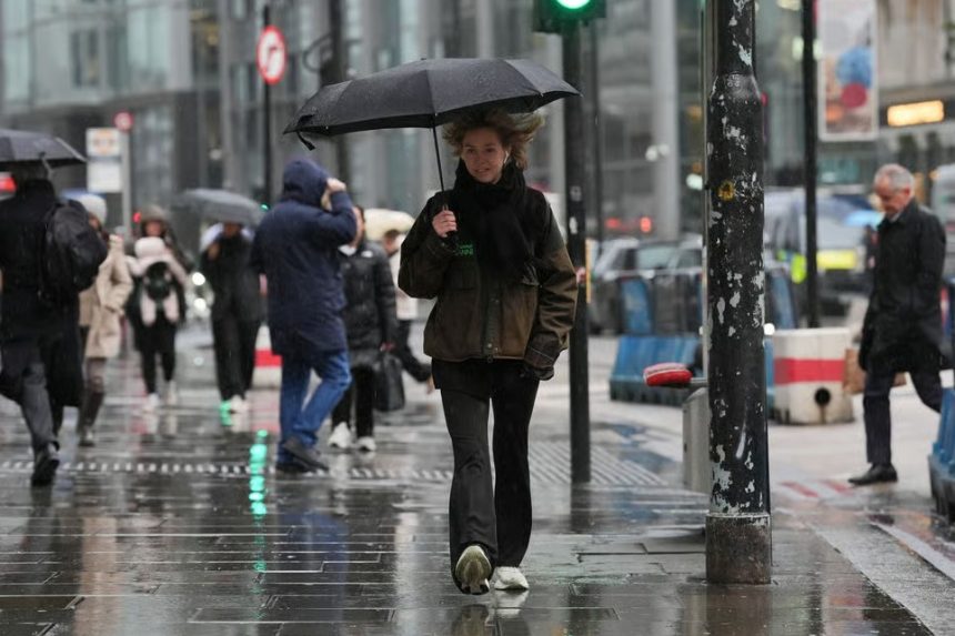
While some regions will enjoy a “spring-like” Saturday, a significant Atlantic weather front is currently tracking toward the British Isles.
This system is expected to bring a combination of heavy showers, coastal gales, and even a dusting of hill snow to parts of the country before the weekend is out.
What is the Weather Forecast for Today, Saturday, 14 March?
Yesterday, Friday, 13 March, the United Kingdom experienced unsettled conditions, with a mix of rain and snow. Daytime temperatures reached a high of 4°C, with a 40% chance of snow, westerly winds at 8 mph, and a high humidity of 88%.
As evening approached, the precipitation eased to mostly cloudy skies with a low of 0°C. This transitional period set the stage for the frosty start seen across the country this morning.
The weather today is largely dictated by a blustery westerly airflow. For most of England and Wales, Saturday is starting as a dry and relatively bright day.
A cold start to Saturday morning with a few icy stretches around 🥶
Plenty of sunshine to come but with some blustery showers, these mainly in the northwest 🌦️ pic.twitter.com/GSSTI50OyO
— Met Office (@metoffice) March 13, 2026
- In the Northwest: Residents in Cumbria, Lancashire, and Western Scotland are seeing the brunt of the activity. Blustery showers, “heavy at times,” are expected to persist throughout the afternoon.
- In the South and East, Cities like London, Reading, and Norwich will see the best of the sunshine. Winds here are lighter, and temperatures are reaching a respectable 11°C, making it feel quite pleasant in the sun.
- The Chilly Factor: Despite the sunshine, it remains “rather cold” in the northwest due to wind chill from frequent showers.
Where Will the Rain and Coastal Gales Hit Hardest on Sunday?
The weather takes a more unsettled turn on Sunday, 15 March, as a more organised band of rain pushes across the United Kingdom.
The Met Office warns that while the east may start with “sunny spells,” the rain will “spread eastwards” rapidly during the morning. By the afternoon, the rain is expected to clear into the North Sea, leaving a trail of “heavy showers” in its wake.
Coastal Gales: Of particular concern are the “coastal gales” forecast for the North. Areas along the Scottish coastline, Northern Ireland, and the North East of England could see gusts strong enough to impact high-sided vehicles and ferry services.
If you are planning to travel via the A1(M) or cross the Irish Sea, extra caution is advised.
Will it Snow in the UK Tonight and Tomorrow?
For those in the northernmost reaches of the country, winter hasn’t quite finished. As a chilly air mass settles over the UK tonight, temperatures in rural areas and across Scotland are expected to “fall below freezing.”
- Tonight: The combination of clear skies and dropping temperatures will bring a “patchy frost” to many inland areas.
- Sunday Morning: As the rain front arrives from the west, it will collide with this cold air. This is expected to trigger hill snow in Scotland, primarily across the Highlands and the Grampians.
While significant accumulations at low levels are unlikely, commuters using high-level routes like the Pass of Drumochter should be prepared for wintry driving conditions.
How Will the Weather Affect UK Travel and Public Services?
The transition from a dry Saturday to a wet and windy Sunday will have several knock-on effects for the UK public:
- Transport & Commuting: National Highways and Transport for London (TfL) are monitoring the forecast. The Sunday rain band is likely to create “surface water spray” on major motorways, including the M1, M6, and M25, increasing braking distances.
- Public Safety: The UK Environment Agency has reminded residents in low-lying areas of the South West to stay alert. With ground saturation levels high, the heavy showers on Sunday could lead to localised flooding of “vulnerable roads and basements.”
- Energy and Heating: With temperatures dipping below freezing tonight, the NHS and local councils are reminding the elderly to keep homes heated, as the “sudden drop” in evening temperatures can exacerbate underlying health conditions.
What is the Long-Range Forecast for the Rest of March?
Looking beyond this weekend, the “changeable” theme is set to continue. After the Sunday front clears, Monday will likely see a return to “sunshine and blustery showers,” with the heaviest rain again focused in the north.
However, there is a “glimmer of hope” in the mid-week models. The Met Office indicates that high pressure may begin to build from the south by Wednesday or Thursday, potentially bringing a period of more stable, warmer weather to much of the United Kingdom.
This would be a welcome relief for the agricultural sector and those eager for a consistent start to spring.