
The United Kingdom’s brief encounter with settled spring weather is set to come to an abrupt halt this week.
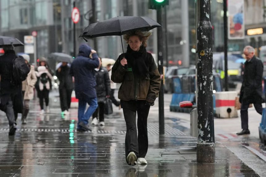
The Met Office has issued a series of warnings as a powerful Atlantic weather system moves across the British Isles, bringing a volatile mix of 70mph gales, persistent heavy rain, and a sharp drop in temperatures.
Starting today, Monday, 23 March 2026, a “weather divide” is in place. While southern England enjoys the final hours of hazy spring sunshine, northern regions are already seeing the vanguard of a cold front that will sweep the entire country by Tuesday.
With over 27 flood alerts already active and major transport hubs preparing for disruption, this article provides the authoritative breakdown of what every UK resident needs to know for the next 48 hours.
Why is the Weather Changing So Abruptly?
The current shift in the UK weather forecast is driven by a strengthening jet stream pushing a deep area of low pressure towards northern Scotland.
This “active weather front” is acting as a conveyor belt for moisture-laden air, which will clash with the milder air mass currently sitting over the Midlands and the South.
A chilly start to Monday morning, with some frost and fog in places 🌫️
Dry, with hazy spells of sunshine for England and Wales ☀️
Cloudier skies developing for Northern Ireland and Scotland, with rain moving into the far northwest 🌧️ pic.twitter.com/LL7D6Sah2E
— Met Office (@metoffice) March 22, 2026
Meteorologists at the Met Office have noted that the transition will be rapid. On Monday night, rain will sink south into Northern Ireland and Northern England, while “severe gales” develop in the far north.
By Tuesday, the front will stall over Wales and Northern England, leading to prolonged periods of rainfall that could exceed monthly averages in just 24 hours in upland areas.
Which UK Regions Face the Highest Risk?
The impact of this unsettled period is not uniform, with specific “danger zones” identified by local authorities:
- Northern Scotland & The Highlands: This region is the “front line” for the wind. Gusts of 60-70mph are expected, particularly across the Hebrides, Orkney, and Shetland.
- Wales and the Brecon Beacons: Forecasters warn of a “persistent washout” on Tuesday. Heavy, heavy rain will be concentrated here, with the potential for localised flash flooding.
- The Pennines and Northern England: As the rain “sinks south,” it will turn heavy and blustery across cities like Manchester, Leeds, and Sheffield.
- Southern England and London: While starting dry and hazy on Monday, these areas will experience a “temperature plunge” by Tuesday evening, with mist and fog patches replaced by squally showers.
What are the Authorities Saying?
Verified data from UK government agencies and weather experts highlight the severity of the incoming system:
- Met Office: Chief Forecaster Jason Kelly confirmed that “blustery showers moving into the north on Tuesday may carry a risk of hail and thunder,” with a transition to colder air bringing sleet to high ground.
- Environment Agency: As of Monday morning, 27 flood alerts are in force across England. Significant concern remains for the South Winterbourne Valley and the River Kennet due to high groundwater levels.
- Traffic Scotland & National Rail: ScotRail has already implemented speed restrictions on the West Highland Line and the Highland Main Line. In the south, South Western Railway has reminded passengers of modernising works at Clapham Junction, which, combined with the weather, could add 15 minutes to journey times.
How Will This Affect Your Commute and Daily Life?
The public should prepare for “cascading” impacts across infrastructure:
1. Transport Disruptions
Commuters using the A9 in Scotland or the M6 through the Lake District should expect high-wind warnings and surface water.
In the maritime sector, Caledonian MacBrayne (CalMac) ferry services on the West Coast are likely to be affected by “very rough” sea conditions.
2. Risk to Property and Power
With gales hitting 70mph in the north, there is a moderate risk of short-term power outages caused by fallen branches hitting overhead lines. Residents in Aberdeenshire and the Western Isles are urged to secure outdoor items.
3. Public Health and Safety
The UK Health Security Agency (UKHSA) continues to monitor temperatures as they drop back to single digits.
While no formal “Cold Health Alert” is currently active for this specific 48-hour window, the “wind chill” factor will make it feel significantly colder than the recorded 8-10°C.
The “Polar” Shift: What Happens After Tuesday?
Once the main rain belt clears on Tuesday night, the UK enters a “polar maritime” airflow. This means the weather will remain unsettled through Wednesday and Thursday, but the nature of the threat changes. We expect:
- Sun and Squalls: A mixture of bright intervals and heavy, “sting-in-the-tail” showers.
- Wintry Hazards: Sleet and snow are likely over the Scottish mountains and potentially the Peak District above 300m.
- Night Frosts: A return to patchy rural air frosts as skies clear between showers.
Visual Data and Comparison Table
| Region | Peak Wind Gusts (Expected) | Primary Weather Threat | Impact Level |
| Scotland (North) | 65–75 mph | Severe Gales / Power Risk | High |
| Wales | 35–45 mph | Persistent Heavy Rain | Medium |
| Northern England | 40–50 mph | Surface Water Flooding | Medium |
| Southern England | 25–35 mph | Temperature Drop / Fog | Low |