
The United Kingdom is currently split by a dramatic weather divide as a surge of continental warmth brings the hottest day of the year so far to the South East, while a powerful Atlantic front prepares to sweep the nation with rain and significantly cooler air.
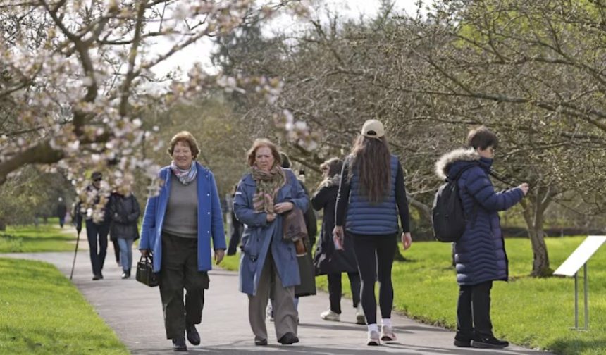
Today, Wednesday 8 April, temperatures are expected to peak at a record-breaking 23°C in parts of London and East Anglia, nearly double the seasonal average.
This follows a period of building pressure where a UK weather mini-heatwave has been gaining momentum across southern counties. However, the Met Office has warned that this “spring sizzle” is a fleeting event.
By tomorrow, a band of rain currently hovering over Northern Ireland and Scotland will migrate southeast, bringing a “reality check” to the British public with temperatures tumbling back into the low teens.
Why Is the UK Seeing This Sudden Temperature Spike?
The current warmth is the result of a “pumping” effect from the jet stream, which has buckled to the north, allowing a plume of warm, dry air to be drawn up from the Mediterranean and North Africa. This has created settled, blue-sky conditions for much of England and Wales.
A chilly start for some on Wednesday, with perhaps a touch of frost in prone spots. But under sunny skies, temperatures will quickly rise for most with lighter winds than on Tuesday ☀️➡️📈
Somewhat cloudier and cooler in Scotland and Northern Ireland with the odd light shower ☁️ pic.twitter.com/eAfHBG9R8t
— Met Office (@metoffice) April 7, 2026
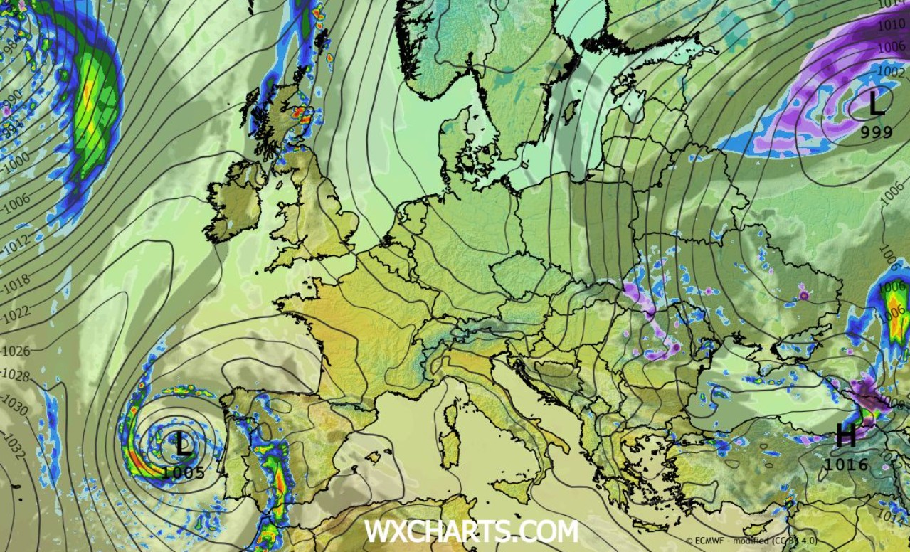
However, this high-pressure system is being squeezed by an approaching low-pressure trough from the Atlantic.
This “battle of the air masses” is responsible for the stark contrast: while Kent and Essex enjoy summer-like sunshine, Western Scotland and County Fermanagh are already experiencing the leading edge of the cold front, characterized by thick cloud and persistent drizzle.
Which UK Towns and Cities Will See the Biggest Changes?
The transition from “fine and dry” to “cool and changeable” will be most felt in the following regions:
- The Heat Peak (Wednesday): London, Cambridge, Norwich, and Reading will see the highest temperatures, likely hitting 21°C to 23°C by mid-afternoon.
- The Rain Arrival (Wednesday Night): Rain will intensify across Belfast, Glasgow, and Stirling overnight, before moving into the North West of England.
- The Thursday “Cool-Down”: Cities like Manchester, Liverpool, and Birmingham will wake up to a damp Thursday with temperatures capped at 14°C. The South East will remain dry for most of the day before the rain finally arrives late on Thursday evening.
How Will the Rain Front Affect UK Travel and Commuters?
Official statements from National Rail and National Highways suggest that while no major weather warnings are in place, the sudden shift to wet conditions poses risks.
“The first significant rain after a dry spell can lead to ‘greasy’ road surfaces as oil and rubber deposits mix with water.
Motorists on the M6, M62, and A1(M) should expect spray and reduced visibility as the front moves south throughout Thursday,” warned a National Highways spokesperson. “
In Gloucestershire, police have already warned of “severe delays” on the M5 and A417 due to scheduled abnormal load movements coinciding with the changing weather, further complicating the Thursday evening rush hour.
Is This the End of the “Easter Warmth”?
For many, today’s weather feels like a belated Easter treat, but the long-term outlook suggests a return to typical British spring volatility.
Expert analysts from the Met Office indicate that after the rain clears on Friday, the UK will enter a “showery regime.”
Data from the Environment Agency indicates that while the rain is moving quickly, it will provide a minor boost to soil moisture levels following a relatively dry March.
However, for those planning outdoor activities, the “feels-like” temperature on Friday and Saturday will be significantly lower due to a brisk northwesterly wind, making 12°C feel more like 8°C.
Impact on UK Agriculture and Food Prices
The weather isn’t just a topic of conversation; it’s a financial factor. The Energy and Climate Intelligence Unit (ECIU) recently noted that “successive climate shocks,” including erratic spring shifts like the one seen today, have contributed to a rise in lamb and vegetable prices.
Farmers in Wales and the South West have reported that the waterlogged soils from earlier in the year followed by sudden heat can stress livestock and delay crop growth.
This “seesaw” weather pattern makes it difficult for UK growers to manage planting cycles, leading to what some are calling a “climate premium” on British supermarket shelves.
What Should You Prepare for Over the Next 24 Hours?
The public is advised to enjoy the sunshine today but prepare for a sharp shift:
- Hydration & UV: Despite being early April, the UV index is “Moderate” (4). Sun protection is advised in the South.
- Evening Drop: Temperatures will fall quickly tonight under clear skies in the East, while the North stays mild but wet.
- Thursday Gear: Ensure umbrellas and waterproofs are ready for the morning commute in the North and the afternoon/evening in the Midlands and South.