
A major snow forecast is warning of a powerful UK snow bomb set to hit large parts of the country on 13 February, with some areas facing up to 18 inches of snowfall.
Weather maps suggest the system could stretch from Edinburgh to Newquay, covering a 528-mile radius and affecting millions across the UK as winter conditions intensify towards mid-February.
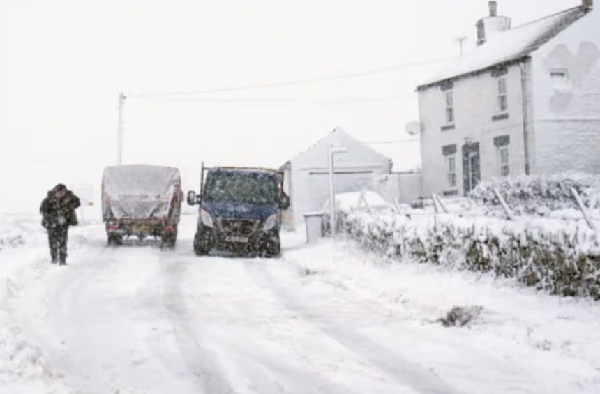
What is the UK snow forecast warning about?
Weather charts from WX Charts, using Met Desk data, show a widespread band of snow pushing across the UK in mid-February.
Forecasters say the system could turn much of the country white within hours, with Scotland expected to take the hardest hit.
In Moray, northern Scotland, snowfall totals could reach 47 centimetres (18 inches), making it the worst-affected area under current projections.
Even southern regions, usually spared from deep snow, could see significant accumulations.
Which parts of the UK will see the most snow?
The latest snow forecast maps indicate near-nationwide coverage:
- Scotland: Up to 47cm (18 inches) in Moray
- England: Around 7–9cm in many areas
- Highlands: Temperatures plunging to -8°C
- Southern England: Overnight lows close to -2°C
From Edinburgh in the north to Newquay in Cornwall, few places appear outside the snow zone if the forecast holds.
When is the snow expected to hit?
According to WX Charts projections, the main snow event is expected on Thursday, 13 February, just before the end of January’s unsettled weather pattern gives way to colder air pushing south.
Forecasters stress that snowfall totals can still change, but confidence is growing around a cold and disruptive spell developing in mid-February.
Why is the UK facing another snow bomb?
The Met Office says global weather patterns are playing a key role. A strengthened jet stream, driven by high temperature contrasts over North America, is sending more energetic low-pressure systems towards the UK.
Met Office Deputy Chief Forecaster Stephen Kocher explained: “The temperature contrast in North America is helping to invigorate the jet stream, which is a driver for much of the UK’s weather.
With the jet stream strengthened, this helps to develop and strengthen low-pressure systems and push them towards our shores.”
This setup increases the risk of heavy snow when cold air meets Atlantic systems.
How does this compare with the current UK weather?
In the short term, the Met Office says Sunday will be the drier day of the weekend for many, though showers will still move in from the North Sea coasts and western areas. Skies will remain mostly cloudy, with occasional brighter spells.
However, the unsettled pattern continues into next week, raising concerns over travel disruption and flooding before colder conditions take hold.
Met Office Chief Forecaster Rebekah Hicks warned: “Over the next few days, we’ll see more rain into areas of the country which have already been hit by flooding.
While totals aren’t comparable to Storm Chandra, around 25mm possible each day could still lead to difficult travel conditions.”
Could this snow cause major disruption?
If snowfall reaches forecast levels, impacts could include:
- Travel delays on motorways and rural roads
- Disruption to rail services, especially in Scotland
- School closures in hard-hit areas
- Increased pressure on local councils and grit supplies
Previous widespread snow events have shown that even 5–10cm can cause major issues, particularly in southern England, where infrastructure is less adapted to prolonged snow.