
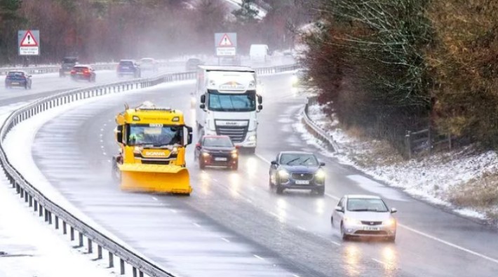
The latest storm Pedro forecast shows snow, ice and heavy rain sweeping across parts of the UK this week, with Wales, central England and the southern Pennines facing the brunt of the cold snap.
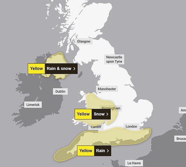
The Met Office has issued yellow weather warnings for ice and snow, while the Environment Agency has placed dozens of areas on flood alert.
The disruption began on Wednesday evening along the southern coast and is expected to continue into Thursday morning, affecting commuters, schools and vulnerable residents.
Storm Pedro, named by Météo-France, has already brought heavy rain to parts of south-western and central England. Forecasters warn that freezing temperatures overnight could create dangerous icy patches on untreated roads and pavements.
What Is the Latest Storm Pedro Forecast for the UK?
- Snow across Wales, central England and higher ground in the southern Pennines
- Sleet and rain are pushing east overnight
- Ice forming on untreated surfaces by early Thursday
- Gradual improvement by Thursday evening
A yellow ice warning covered much of Wales overnight and is due to lift at 10am Thursday. A separate yellow snow warning remains in place in affected regions.
Met Office meteorologist Craig Snell said conditions will “gradually improve later on Thursday as winds ease,” with temperatures potentially rising into the low-to-mid teens by the weekend if sunny spells develop.
Where Are Flood Warnings and Alerts in Place?
Heavy rainfall has triggered widespread alerts across England.
According to the Environment Agency (data released Wednesday evening):
| Alert Type | Number Issued | Meaning |
|---|---|---|
| Flood Warnings | 78 | Flooding is expected – immediate action required |
| Flood Alerts | 217 | Flooding is possible – be prepared |
Flood-prone areas along southern and central England remain under close watch. Rivers already swollen from earlier storms this year increase the risk of surface water flooding.
Residents can check live updates on GOV.UK and local council websites.
How Will Snow and Ice Affect Travel and Public Services?
Snow and ice could cause:
- Slower road journeys during morning commutes
- Train delays on exposed or elevated routes
- Slips and falls on untreated pavements
- Disruption to school transport in rural areas
The UK Health Security Agency has issued a cold-weather health alert covering:
- East Midlands
- West Midlands
- North East
- North West
- South West
- East of England
- Yorkshire and the Humber
Health officials warn that sudden temperature drops can increase hospital admissions, especially among elderly people and those with heart or respiratory conditions.
In previous cold snaps, NHS trusts reported spikes in A&E visits due to falls on ice. Local councils urge residents to grit pathways where possible and check on vulnerable neighbours.
Why Has Storm Pedro Brought Such Unpredictable Weather?
The UK has experienced several named storms already this year. Saturated ground from earlier rainfall means even moderate downpours increase flood risks.
Storm Pedro developed over continental Europe before pushing north-west towards the British Isles. As colder Arctic air met moist Atlantic systems, forecasters expected a mix of rain, sleet and snow, particularly over higher ground.
Meteorologists say these rapid weather shifts are typical during transitional winter periods, when mild and cold air masses collide.