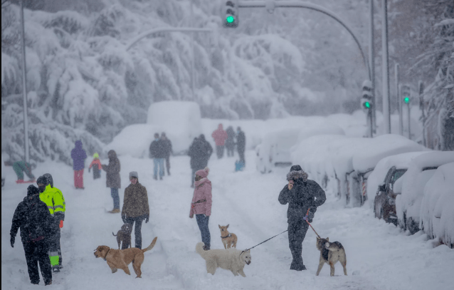
Greater Manchester is preparing for its first taste of winter this week, with snow potentially arriving as early as the weekend. Forecasters are warning that plummeting temperatures could bring wintry showers to the region by Sunday or Monday.
Snow to Blanket Manchester as UK Faces Early Winter Chill
The UK is on the verge of its first significant cold spell of the season, and it’s arriving sooner than expected.
According to the latest data from WXCharts, which is based on MetDesk forecasts, a plunge in temperature is on the way, taking much of the country with it.
The charts show that snow could fall across northern parts of the UK, including Greater Manchester, from late this week into early next.
Key details include:
- Snow could arrive in Manchester as early as Sunday
- Temperatures set to fall to around 0°C
- Northern regions, Wales, and Scotland are also at risk
- Lows of -2°C expected in the North Pennines by Monday
The Mirror reports that snowfall could begin as early as Thursday in some areas, particularly across Scotland and northern England. Wales is also in the frame for flurries, with the risk increasing as the weekend approaches.
Widespread Snow Across UK by the Weekend
Scotland is expected to be first in line, with flurries likely from Friday and more sustained snowfall predicted through the weekend. By Sunday, the snowy conditions could stretch further south.
The WXCharts data paints a wintry picture:
- From 6am on Saturday, 26 October, Wales, northern England and Scotland could be blanketed.
- Sunday into Monday (27 October), snowfall is forecast to extend into Northern Ireland, the Midlands, and even eastern and western coastal areas of England.
In particular, regions like North Yorkshire, Durham, and Northumberland may experience harsh overnight lows and significant frost.
This weekend could mark a dramatic weather shift, with early signs of winter sweeping across the UK. Snowfall isn’t just a possibility—it’s increasingly looking like a certainty for some.
Met Office: Colder Days Ahead
The Met Office has confirmed that unsettled conditions will continue for the remainder of October, hinting at a colder-than-average end to the month.
The long-range forecast for Friday, 24 October to Sunday, 2 November states: “Remaining unsettled to start the period as an area of low pressure clears into the North Sea.
Outbreaks of rain, heavy at times, and strong winds will likely ease through Friday as the low continues to move eastwards.
This will leave a colder northerly flow for a time at the weekend, which will be showery around the coasts but with sunny spells inland. Into the following week, conditions are expected to be changeable with showers or longer spells of rain across many parts of the UK.
The cold northerly will likely give way to a more changeable westerly pattern, and the wettest weather will probably be in parts of the north and west. Temperatures are expected to be close to or slightly below normal for the time of year.”

Prepare for a Cold, Wet Start to November
While the snow might not stick around for long, the shift to a colder and wetter weather pattern suggests the UK is firmly on the path towards winter.
The frequent rain, brisk winds, and overnight frosts will be a stark contrast to the mild start we saw earlier this autumn.
Residents across Greater Manchester and beyond are advised to keep a close eye on local forecasts, especially those planning to travel over the weekend.
Pack your coats, check your tyres, and brace for a very wintry turn. The UK’s first true taste of cold is coming, and it’s bringing snow with it.


