
The UK is currently caught in a meteorological tug-of-war as we transition from March into April 2026.
While Monday brings a sharp reminder of winter with blustery showers and hill snow, Tuesday offers a fleeting glimpse of spring warmth before a definitive geographical divide takes hold for the month ahead.
From coastal gales in the North to flood alerts in the East, here is how the shifting atmosphere is impacting the British Isles today.
What Is Hitting the UK Today?
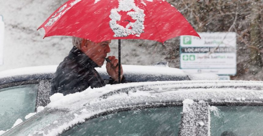
The core development today is a fading low-pressure system currently dragging cold, polar air across Scotland and Northern England.
This is resulting in blustery showers, which are turning to snow over higher ground, particularly across the Scottish Highlands and the Pennines.
A chilly start on Monday morning but lots of sunny spells across England and Wales 🌥️
Some showers may filter in at times, particularly in the north, where they may be wintry over high ground 🌦️ pic.twitter.com/86rbe3rCvW
— Met Office (@metoffice) March 29, 2026
However, this is a fast-moving setup. By Tuesday afternoon, a transient ridge of high pressure will push temperatures into the mid-teens for southern residents.
This “weather sandwich”, cold air followed by a warm surge, followed by a return to unsettled conditions, is becoming a hallmark of the 2026 spring season, driven by a highly mobile jet stream.
Where Are the Biggest Regional Impacts?
The UK’s diverse topography means “one forecast” rarely fits all. Today’s regional breakdown includes:
- The Highlands & Pennines: Significant hill snow is expected above 300 metres. The Scottish Avalanche Information Service has already noted “considerable” hazard levels in the Northern Cairngorms due to fresh windslab accumulation.
- The Norfolk & Suffolk Coast: The Environment Agency has issued flood alerts for the Hunstanton coast and the Suffolk coast at Southwold. Large waves and a North Sea surge are making coastal paths particularly hazardous.
- London & The South-East: While largely dry today with sunny spells, Tuesday will see a surge in humidity and “outbreaks of rain and drizzle.” Expect a “grey start” to the workday at major hubs like London Bridge and Waterloo.
How Is This Affecting UK Travel and Infrastructure?
Commuters and logistics firms should be wary of localized disruptions:
- Rail Engineering & Adhesion: Thameslink and Southern have reported overnight engineering works between Three Bridges and Brighton (30 March – 2 April), compounded by “greasy rail” conditions from light drizzle and leaf debris.
- Coastal Gales: Force 6 winds are currently active from Loop Head to Malin Head, impacting small craft and ferry crossings.
- Energy Demand: As the Met Office predicts a “turn to colder weather” toward the weekend of April 3rd, energy analysts suggest a minor spike in domestic gas heating demand, coinciding with the April 1st Ofgem price cap adjustments.
Why Does the Long-Range Forecast Show a “North-West Split”?
Looking ahead to the period of April 3 to April 12, a classic UK weather pattern is emerging. A broad “north-west to south-east split” means:
- North-West: Will remain unsettled as low-pressure systems track in from the Atlantic, bringing strong winds and longer spells of rain.
- South-East: Will benefit from the “greater influence” of high pressure, leading to more settled, drier, and occasionally frostier nights.
Statistically, April 2026 is following a trend where temperatures remain “near or slightly above normal,” but the frequency of Atlantic depressions is keeping the North-West significantly wetter than the historical average.
FAQ
Will it snow in my area today?
Snow is strictly limited to higher elevations today, specifically the Scottish Highlands, the Southern Pennines, and the Sperrins in Northern Ireland. Lower levels will see “blustery showers” that may contain sleet but will not result in lying snow.
Are there any active flood warnings in the UK?
As of Monday, 30 March, there are 4 active flood alerts in Norfolk and Suffolk, including Southwold and Lowestoft. Groundwater flooding alerts also remain in place for parts of the South Winterbourne Valley and the River Lambourn.
What should I expect for the April 2026 weather?
Expect a “split” month. The first half of April will be unsettled in the North but drier in the South. Towards late April (13th–27th), high pressure may bring more widespread “settled and dry” weather across the UK.
Is it safe to travel on the trains today?
While most services are running, check for bus replacement services on the Southern and Thameslink lines between Three Bridges and Brighton. High winds in the North may also lead to speed restrictions on certain exposed rail routes.