
The latest UK weather forecast shows northern parts of the country bracing for strong winds and colder conditions.
The Met Office has issued yellow wind warnings on Thursday covering Scotland, Northern Ireland, northern England, North Wales and parts of the north Midlands.
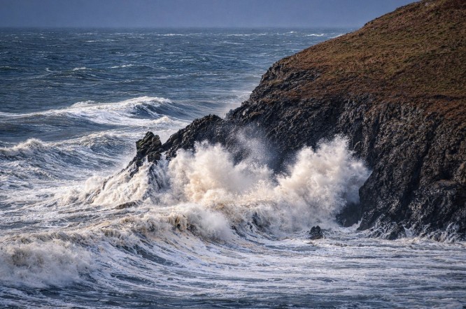
Gusts could reach 50–60mph, with isolated bursts over 70mph, leading to potential transport disruption and hazardous driving conditions.
A cold front moving southwards will bring heavy rain, followed by a sharp drop in temperatures, and wintry showers on higher ground later in the week. Northern UK residents are advised to check travel updates and prepare for changing conditions.
Which Areas Are Affected by the Wind Warnings?
The Met Office yellow warning covers large parts of northern Britain and will remain active for most of Thursday.
- Scotland, northern England, North Wales, north Midlands: 05:00–20:00 GMT
- Northern Ireland: 06:00–12:00 GMT
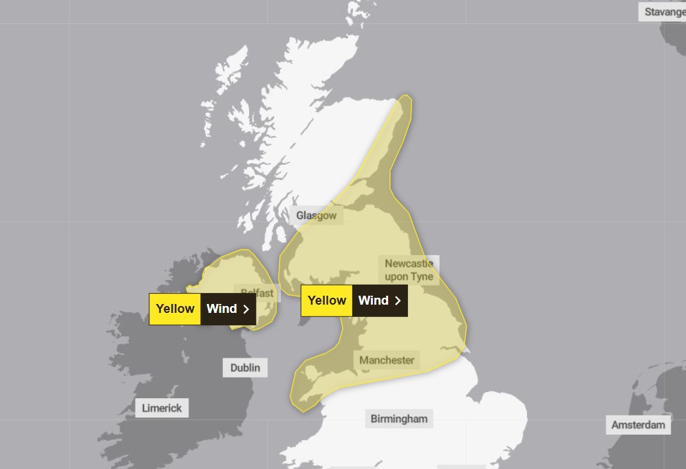
The strongest winds will move through Scotland and Northern Ireland in the morning, spreading south and east to northern England and the Midlands by the afternoon.
Exposed routes like the M6, A1 and A68 may experience challenging driving conditions, especially for high-sided vehicles.
How Strong Will the Winds Be?
According to the Met Office weather forecast, winds will be widespread and not limited to coasts or hills. Gusts are expected to reach 50–60mph, with isolated gusts above 70mph in certain exposed locations, particularly in the Hebrides and other coastal areas.
Transport authorities warn that high winds could cause ferry cancellations, road delays and rail disruption across the north.
Could Travel Be Disrupted?
Yes. Transport services may experience some disruption as the weather system passes through. Authorities have warned travellers to check updates before setting out, especially in northern areas where winds will be strongest.
Possible impacts include:
- Ferry delays or cancellations in Scotland
- Difficult driving conditions for lorries, vans and caravans
- Localised rail delays due to strong crosswinds
- Slower journeys on major motorways and A-roads
Some ferry routes in Scotland have already experienced disruption earlier this week due to strong winds.
Why Is the UK Experiencing Such Strong Winds?
Meteorologists say the unsettled conditions are being driven by a powerful Atlantic jet stream, a fast-moving band of air high in the atmosphere.
The jet stream is currently reaching around 220mph, helping to generate intense areas of low pressure in the North Atlantic.
Although the centres of these low-pressure systems remain well to the northwest of the UK, they are still close enough to bring strong winds across Britain.
Recent wind readings show how intense conditions have been:
- 74mph gust recorded at South Uist Range in the Hebrides
- 68mph gust recorded in Orkney
These conditions earlier in the week led to several ferry services being cancelled.
When Will Snow Affect UK Mountains?
After the cold front moves through the country, colder air will follow, allowing showers to turn wintry across northern regions. Snow is most likely on higher ground, particularly above 200 metres in elevation.
Areas most likely to see snow include:
- Scottish Highlands
- Hills of Northern Ireland
- Pennines in northern England
- Mountains of North Wales
Forecasters say the highest parts of Scotland could see snow accumulations of 10–20cm, especially on exposed peaks.
What Will Friday’s Weather Look Like?
Friday is expected to feature a sunshine and showers pattern, with gusty winds pushing quick-moving showers across the country. Some showers may include hail or isolated thunder, though most will pass rapidly.
This means residents may experience bright spells followed by short bursts of rain, rather than prolonged wet conditions.
Will the Windy and Cold Weather Continue?
Yes. The unsettled weather is likely to continue into the weekend. Forecasters predict:
- Strong winds are returning on Sunday
- Wintry showers in northern areas
- Cold air lingering into early next week
Travel disruption and rapidly changing conditions could persist for several days, particularly in northern and western regions.
What does this mean for UK Residents?
For many people across northern Britain, the biggest impact will be short-term travel disruption and gusty winds rather than prolonged severe weather.
Residents are advised to take simple precautions such as:
- Checking travel updates before long journeys
- Securing loose outdoor items
- Allowing extra time for commuting
- Monitoring ferry and rail service updates
Those planning trips into mountain regions should also prepare for snow and rapidly changing weather conditions.