
Storm Ingrid is lining up to batter the UK, raising fears of heavy snow, flooding and travel disruption as bitterly cold air clashes with Atlantic storms.
Forecasters warn parts of Britain could see temperatures fall as low as -10°C in the days ahead, with snowfall possible in several regions.
The unfolding UK weather situation matters because it could disrupt travel, strain flood defences, and hit household energy use just as winter tightens its grip. Millions across England, Scotland and Wales may feel the impact over the coming week.
What is Storm Ingrid and why is it hitting the UK now?
Storm Ingrid is part of a chain of low-pressure systems racing in from the Atlantic. These storms are being powered by an intense deep freeze over Canada and the United States, which has strengthened the jet stream flowing towards Europe.
At the same time, cold easterly winds are pushing in from eastern Europe and the Baltic. This sets up a direct clash of air masses over the UK, a classic trigger for unstable winter weather.
Met Office meteorologist Aidan McGivern explained the risk clearly: “Into the end of the weekend, we have easterly winds making inroads into the west, but we also have the jet stream and Atlantic lows gearing up to come in.
This is the first clash of Atlantic lows with cold air from the east.”
Where could snow fall and when is the coldest spell expected?
The highest risk of snow begins from Monday onwards, when bands of heavy rain may turn to snow as they meet freezing air.
Eastern regions are most exposed to plunging temperatures this weekend, while western areas face persistent rain first.
Storm Ingrid (named by the Portuguese Met Office) will see some rain move north across the Black Country today. Max high of 8C. Turning drier evening time.
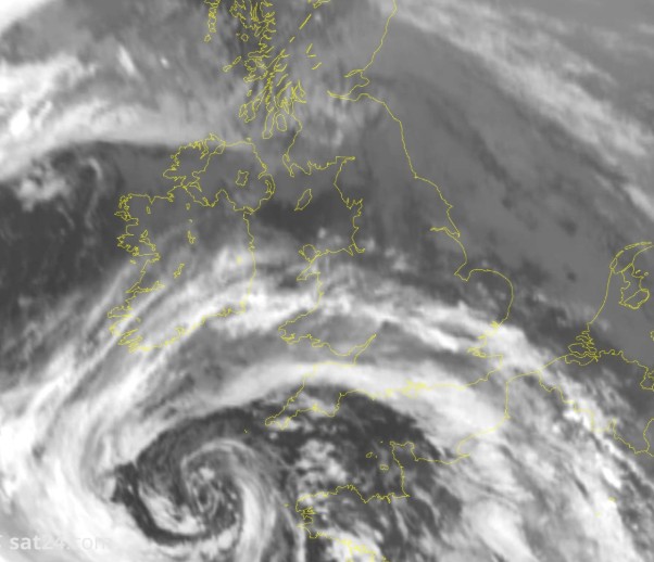
(Below) Textbook swirl of cloud highlighting where the centre of Storm Ingrid is in the SW. Not impactful for our region. pic.twitter.com/4EWqCFKgqy
— Black Country Weather🌪️🌩️❄️ (@BlackCountryWX) January 23, 2026
Snow is most likely:
- Over high ground, especially in Scotland
- In eastern and central England, if cold air holds firm
- Across northern areas during overnight periods
McGivern warned that small shifts in storm direction could make a big difference: “As a band of heavy rain turns up on Monday, it bumps into the cold air and may turn to snow, but where depends on the exact orientation of the low.”
How cold could temperatures get across the UK?
If easterly winds dominate, overnight temperatures could drop sharply. Forecasters say lows of -10°C are possible in rural and sheltered spots, particularly in northern and eastern Britain.
Jim Dale, meteorologist for the British Weather Service, said: “Next week we start to see lower temperatures with a greater risk of snow, particularly in prone regions like the Highlands and the Grampians. Temperatures could sink as low as minus 10°C overnight.”
While not a full “Beast from the East”, the pattern would still feel notably colder than recent weeks.
Why are forecasts uncertain this time?
Weather models remain split because the jet stream plays a decisive role. A weaker jet allows cold air from the east to spread further west, increasing snow risk. A stronger jet forces milder, wetter Atlantic weather across the country.
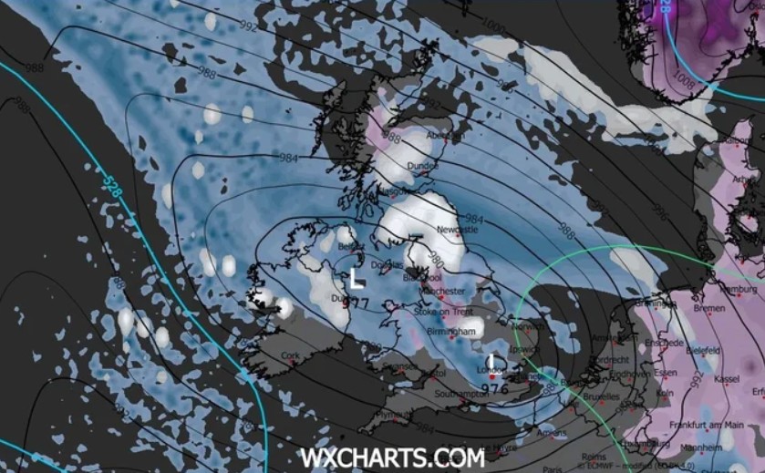
Behind this uncertainty lies the North American freeze. As McGivern noted, “When we get these cold outbreaks across North America, that fuels a powerful jet stream making its way across the Atlantic. That’s why it’s going to be complicated.”
Which areas face flooding before snow arrives?
Before any snow settles, eastern Scotland sits firmly in the firing line for torrential rain. Some areas could see up to four inches of rain within 24 hours, adding pressure to already swollen rivers.
The Met Office has active warnings for:
- Travel disruption
- Fast-flowing flood water
- Possible power cuts
A Met Office spokesperson said: “Rain will fall increasingly as snow over high ground, adding to the uncertainty over how quickly rivers may respond downstream.”