
The United Kingdom is navigating a volatile transition in weather patterns this week. While Thursday 26 March offers a temporary reprieve with dry and bright conditions for many, the Met Office has confirmed that a powerful Atlantic frontal system is poised to sweep across the country.
This transition marks the end of a brief settled spell, ushering in heavy rain, strengthening winds, and a return to wintry showers in the north by Friday, 27 March.
Will the Sunshine Last?
For the majority of England and Wales, Thursday began on a fine note. Following the clearance of early wintry showers in northeast Scotland, a transient ridge of high pressure has allowed for sunny intervals.
However, the air remains crisp, with temperatures struggling to reach double digits in many northern areas. In London and the Southeast, highs of 10°C are expected, while Edinburgh will feel cooler at 8°C.
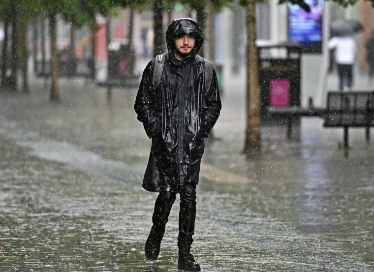
A frosty start on Thursday with slippery surfaces and icy patches❄️
Windy in northeast Scotland with sleet and snow showers. Otherwise, a mostly dry and sunny morning with much lighter winds than on Wednesday🌤️
Showery rain arriving in Northern Ireland and western Scotland🌧️ pic.twitter.com/6tpyftaGA5
— Met Office (@metoffice) March 25, 2026
This “window” is geographically specific. At the same time, the east remains bright, the western fringes of Northern Ireland and western Scotland are already seeing increasing cloud cover and strengthening southerly winds as the leading edge of a new depression arrives.
Where Will the Rain Hit Hardest? Friday’s Moving Front
The “unsettled” phase begins in earnest tonight. As we move into Friday, the weather takes a significantly more turbulent turn.
- Tonight (Thursday Night): A band of heavy rain will push into Northern Ireland and western Scotland, before sliding southeast. High-altitude areas in the Lake District and Snowdonia (Eryri) are expected to see the most persistent downpours.
- Friday Morning: Commuters in Manchester, Liverpool, and Birmingham should prepare for a wet start. The rain front is expected to be slow-moving, leading to high surface-water accumulation on major routes like the M6 and M62.
- Friday Afternoon: The rain finally reaches the Southeast and East Anglia, though it may become more fragmented by the time it hits London. Behind the rain, a colder maritime air mass will trigger sunnier skies but with frequent, sharp showers.
How Will Rising Water Levels Affect the UK? Latest Flood Alerts
The UK Environment Agency and the Flood Forecasting Centre have raised concerns regarding saturated ground conditions. Despite the drier Thursday, the cumulative rainfall from a wet March has left many river catchments vulnerable.
As of March 26, the following official warnings are in place:
- 4 Flood Warnings: Flooding is “expected” in locations including the South Winterbourne Valley, the Till, and the Bourne Valley.
- 26 Flood Alerts: Flooding is “possible” across a wider area, notably the River Kennet, the River Windrush in Oxfordshire, and the tidal River Yare in Norfolk.
Julie Foley, Director of Flood Risk Strategy at the Environment Agency, urged the public to remain vigilant, noting that “groundwater levels remain exceptionally high in the south of England, meaning even moderate rainfall can lead to renewed flooding of land and roads.“
Why is it Turning Cold Again?
The “sting in the tail” of Friday’s forecast is a sharp drop in temperature following the passage of the rain front. As the wind veers to the northwest, polar air will filter down across the UK.
By Friday evening, rain is expected to turn to sleet and snow over the Scottish Highlands, Grampians, and the Northern Pennines.
While significant accumulations at low levels are unlikely, the Met Office warns that “wintry hazards”, including hail and icy patches, could affect travel on higher-frequency routes such as the A9 and A66.
What Official Advice Has Been Issued for UK Travellers?
UK transport authorities are bracing for a difficult Friday. National Rail and Transport for London (TfL) have advised passengers to check for “short-notice alterations” caused by heavy rain and potential wind-blown debris.
“Visibility will be poor during the Friday morning peak, and we anticipate spray on the motorways to significantly increase journey times,” says a spokesperson for National Highways.
Residents in the South West, particularly Somerset and Dorset, are advised to monitor local council updates as ultra-high volume pumps remain deployed in areas like the Somerset Levels to manage the excess water.
What Happens Next?
The immediate outlook following Friday’s storminess suggests a “split” weekend:
- Saturday 28 March: A chilly, bright start with a touch of morning frost. Most of the UK will enjoy a “sunshine and showers” day, though it will feel significantly colder than earlier in the week.
- Sunday 29 March: Another Atlantic system is expected to clip the southern half of the UK, bringing further rain, while the north remains clearer but cold.
- Long-Range Trend: Met Office models for the period 30 March to 8 April suggest that high pressure may finally begin to build from the southwest. This could lead to a “fairly blocked pattern,” bringing drier and more settled conditions to the south, while the north continues to see passing weather fronts.