
The mild start to November is about to take a dramatic turn. The Met Office has warned that the UK snow forecast is looking increasingly likely as a blast of cold air sweeps across the country, pushing temperatures down by as much as 4 °C in the coming days.
UK Snow Forecast
Before this week, Cardiff enjoyed an affable 14.8 °C, surprisingly warm for this time of year. But the calm is set to break. The Met Office says a cold snap is moving in, and snow could be on the horizon for the corridor of the country.
A band of low pressure will drift northeastwards, bringing heavy rain to much of Wales and the North West of England.
As temperatures continue to tumble, snow showers could arrive as early as Thursday across high ground, including the Cairngorms in Scotland, the corridor of Aberdeenshire, and potentially Eryri( Snowdonia) in north Wales later in the week.
The Met Office long-range forecast reads: “Many central and northern parts of the UK will likely be in a colder but drier regime than of late, with overnight frosts, and a few showers near windward coasts in particular, which may be wintry on high ground.
However, it could remain cloudier, milder and wetter initially across some southern and southwestern areas, with some uncertainty as to how quickly this clears away to the south.”
It adds that most of the UK is likely to experience drier and colder conditions heading into next week, with a chance of hill snow in the north.
Temperature Drop Expected
Independent forecasters agree with the Met Office outlook. Meteorologist Jo Farrow from Netweather noted that while it will feel colder, these temperatures are typical for November.
Even so, Cardiff’s forecast of 10 °C this Saturday marks a sharp fall, more than 4 °C cooler than Monday’s mild high.
“Something colder with a frost risk in the north and even snow showers for Scottish hills, but really it will just pull temperatures to where they should be at this time in November. Southern Britain could hold onto the milder air even into the weekend,” Ms Farrow wrote.
She added that the unsettled pattern isn’t going away anytime soon: “There will also be a lot of rain for parts of the UK, mostly for western areas as low pressures rattle in from the Atlantic.
A large meander southwards in the jetstream will continue to feed low pressures past western Europe to the UK.”
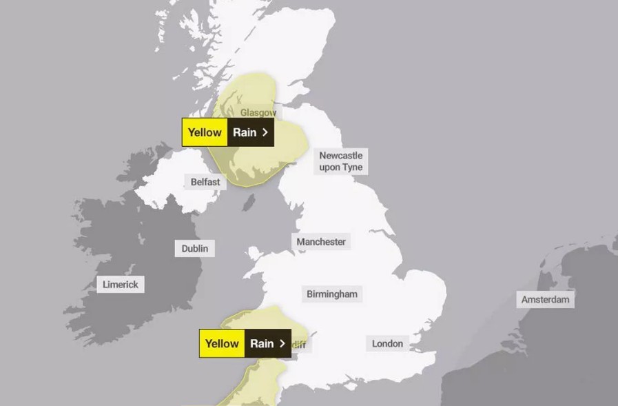
Heavy Rain Warnings
Rain remains a major concern, particularly across western regions. Nearly 40 areas are presently under unheroic rainfall warnings for rain, raising fears of localised flooding, especially in south Wales.
On Monday, Hull recorded further than 30 mm of rainfall, while Cranwell in Lincolnshire saw over 25 mm in just a many hours.
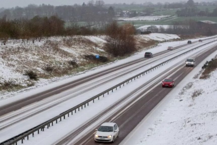
Motorists are prompted to take redundant care, as the shift from heavy rain to freezing conditions could lead to icy patches and trip dislocation.
In summary, Britain’s mild launch to November is snappily fading. The coming days promise a blend of rain, frost, and indeed snow for some areas.
With temperatures dipping sprucely, the UK snowcast is no longer a distant enterprise; downtime is arriving, and it’s arriving presto.
Stay set, stay streamlined, and keep the warm gear close; it looks like the bite is then to stay.