
Britain may have felt unusually mild through early December, but winter appears ready to bite back.
New snow charts suggest that parts of the country could be hit by an icy plunge, blizzard-like conditions and temperatures dipping to –2°C just days before Christmas.
Where Could the Snow Strike Next?
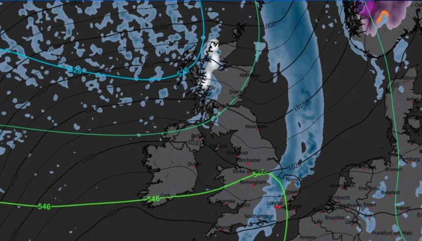
Fresh forecast maps from WXCharts are painting a wintry picture for the festive run-up.
A striking icy-blue band stretches roughly 243 miles across northern Scotland, beginning near Durness in the far north and sweeping down towards Crinan in Argyll and Bute.
These areas, often some of the wildest landscapes in Britain, could see a significant spell of snow on 23 December, according to the model data.
Sheltered Highland spots and areas around Aberdeen, Dundee and Inverness are also expected to feel the chill, with temperatures projected to drop to around –2°C.
However, the Met Office continues to stress that long-range snow forecasts are notoriously difficult.
In its latest update, the forecaster stated that “snow will probably be confined to high ground”, offering some reassurance for those travelling across the UK for Christmas week.
What Is the Met Office Saying About the Festive Forecast?
The official Met Office outlook for 16 December to Christmas Day points to a typical UK winter mix, unsettled at first, then gradually calming.
Early-period forecast:
- Spells of rain are spreading widely across the UK
- Heaviest rainfall likely in western and northwestern regions
- High-ground snow possible in the north
- Strong coastal winds and a risk of gales
- Temperatures “above normal overall” for mid-December
Later-period forecast:
- The weather is becoming steadier and drier, especially in the south
- Higher chances of overnight frost
- Increased likelihood of fog formation
- Still a low risk of snow at lower levels, but not ruled out
Has the UK Seen Significant Snow Already This Season?
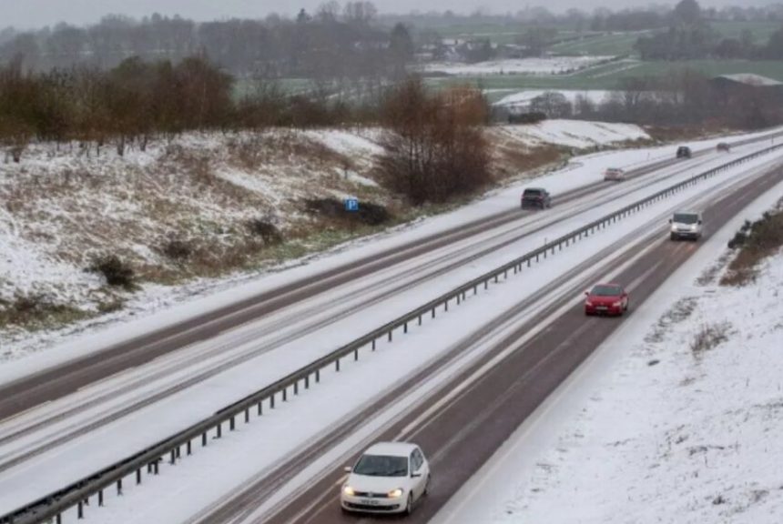
Yes, winter has already delivered a dramatic snapshot. On 20 November, heavy blizzards across the North Yorkshire Moors left hundreds of drivers stranded overnight.
That event served as a reminder of just how quickly UK weather can turn, even after a stretch of mild days.
So far, though, December has been mostly wet and relatively mild. This weekend, yellow weather warnings remain in place for north Wales, northwest England and southwest Scotland, with persistent rainfall expected and totals potentially exceeding 30mm, especially in upland regions.
Strong south-westerly winds could also cause travel disruptions and delays, particularly for those driving long distances ahead of Christmas.
Met Office Five-Day Forecast
Friday:
- Rain lingering across the southeast before clearing
- Sunny spells for many areas
- Blustery showers in the northwest
- Cooler, fresher feel
Saturday–Monday:
- A wet and windy weekend for Scotland and Northern Ireland
- Drier and brighter for southern and central England
- Turning unsettled for all early next week
What Are the Future Chances of Snow?
Longer-range signals suggest a potential pattern shift as we approach late December and early January:
- The jet stream may begin to dip southwards, allowing colder Arctic air to filter into the north of the UK.
- Northern regions could see more frequent wintry showers, while southern England may experience longer spells of dry but frosty weather.,
- If blocking patterns form over Scandinavia, something meteorologists are monitoring, the UK could enter a colder, more settled phase after Christmas, increasing the chance of broader snowfall.
Nothing is guaranteed yet, but the trend is one to watch.
In Summary
- Snow maps show dramatic icy-blue bands over northern Scotland around 23 December
- Temperatures may fall to –2°C in some Highland areas
- Rain and strong winds dominate the short-term outlook
- Widespread UK snow isn’t confirmed, but high-ground snow is likely
- A White Christmas remains possible for northern and upland areas
- Colder late-December conditions could raise snow chances into early January